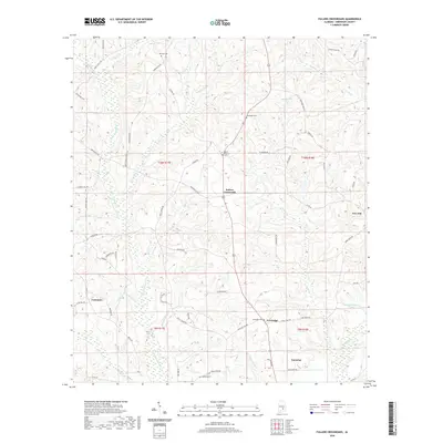
2020 Map of Fullers Crossroads
USGS Topo · Published 2020About this map
Fullers Crossroads and the surrounding rural landscape of Crenshaw County are defined by a network of creeks and small family cemeteries. This 2020 map documents the terrain as it appeared in recent years, showing the north edge of Luverne and smaller settlements like Vernledge and Centenary. The landscape is heavily dissected by watercourses, most notably the Patsaliga Cr and its tributaries, including Little Patsaliga Cr, Sweetwater Cr, and Sikes Mill Cr. Local history is preserved through numerous burial grounds such as Mount Pleasant Cem, Thompson Cem, and Mitchell Cem. The presence of labels like Tomlin Mill Cr suggests the early industrial water-power sites that once served this agricultural region. This map provides a clear view of the modern road network, including Honoraville Rd and Sport Pond Rd, intersecting the traditional land partitions of the Public Land Survey System.
Find a feature on this map
74 named features on this map. Tap any name to fly to it.
Don’t see what you’re looking for? This feature index may not catch every label — zoom into the map to look around manually.
Map Details
Editions of this 2020 Fullers Crossroads Map
This is the sole edition of this map. No revisions or reprints were ever made.
Other maps of this area

1953 · Andalusia
USGS Topo · 1:250,000

1957 · Andalusia
USGS Topo · 1:250,000

1968 · Glenwood
USGS Topo · 1:24,000

1968 · Petrey
USGS Topo · 1:24,000

1968 · Grady
USGS Topo · 1:24,000

1971 · Luverne
USGS Topo · 1:24,000

1971 · Fullers Crossroads
USGS Topo · 1:24,000

1971 · Honoraville
USGS Topo · 1:24,000

1971 · Moodys Crossroads
USGS Topo · 1:24,000

1971 · Danielsville
USGS Topo · 1:24,000