
1968 Map of Glenwood
USGS Topo · Published 1970About this map
The Conecuh River valley defines the lower landscape of this quadrangle, where the Georgia Central Railroad cuts a steady line through the community of Glenwood. This survey period captures a rural economy of small settlements and extractive land use, notably several Strip Mine operations scattered west of the rail line. Small family and community landmarks like Shirleys Crossroads and Social Town are documented alongside numerous country churches, such as Star Hope Ch and Antioch Ch, which served the outlying farmstead populations.
Find a feature on this map
46 named features on this map. Tap any name to fly to it.
Don’t see what you’re looking for? This feature index may not catch every label — zoom into the map to look around manually.
Map Details
Editions of this 1968 Glenwood Map
2 editions found
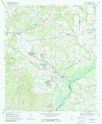
Other maps of this area

1953 · Andalusia
USGS Topo · 1:250,000

1957 · Andalusia
USGS Topo · 1:250,000
1968 · Goshen
USGS Topo · 1:24,000
1968 · Youngblood
USGS Topo · 1:24,000
1968 · Bluff Springs
USGS Topo · 1:24,000

1968 · Bullock
USGS Topo · 1:24,000

1968 · Petrey
USGS Topo · 1:24,000

1971 · Luverne
USGS Topo · 1:24,000

1971 · Brantley
USGS Topo · 1:24,000

1971 · Fullers Crossroads
USGS Topo · 1:24,000