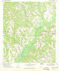
1968 Map of Youngblood
USGS Topo · Published 1970About this map
The Conecuh River marshlands dominate the central basin of this Pike County landscape, where the river's broad floodplains are fed by Beeman Creek and Double Branch. The area’s transportation history is clearly etched by two primary rail systems: the Seaboard Coast Line running east toward the outskirts of Troy, and the Central of Georgia passing through the southern portion near Hephzibah. These corridors fostered small rural nodes like Shellhorn and Youngblood, the latter situated near the eponymous Youngblood Lake.
Find a feature on this map
35 named features on this map. Tap any name to fly to it.
Don’t see what you’re looking for? This feature index may not catch every label — zoom into the map to look around manually.
Map Details
Editions of this 1968 Youngblood Map
2 editions found
Other maps of this area

1948 · Brundidge
USGS Topo · 1:62,500

1950 · Brundidge
USGS Topo · 1:62,500

1953 · Andalusia
USGS Topo · 1:250,000

1953 · Dothan
USGS Topo · 1:250,000

1954 · Dothan
USGS Topo · 1:250,000

1955 · Dothan
USGS Topo · 1:250,000

1957 · Andalusia
USGS Topo · 1:250,000

1960 · Brundidge NW
USGS Topo · 1:24,000
1962 · Brundidge NW
USGS Topo · 1:25,000
1968 · Goshen
USGS Topo · 1:24,000