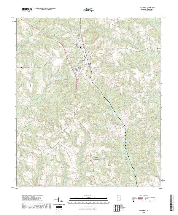
1950 Map of Brundidge
USGS Topo · Published 1950About this map
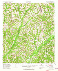
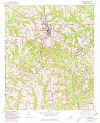
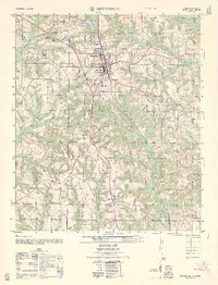
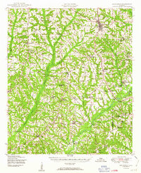
Brundidge serves as the primary hub in this mid-century survey of the Alabama wiregrass region, situated at the junction of the Atlantic Coast Line railroad and several regional highways. The landscape is defined by the winding course of the Pea River and its numerous tributaries, including Whitewater Creek and Big Creek. This era of the countryside is notable for its dense network of rural community centers, often built around combined institutions such as St Johns Church & School and Springfield Church & School. Small-scale industry and early land use are evident in features like the Roeton Millpond and Lowery Mill, reflecting a landscape tied closely to water power and agricultural processing. Along the southern border, the map identifies the edge of the Camp Rucker Military Reservation, marking the transition into federal lands during the post-war period.
Find a feature on this map
61 named features on this map. Tap any name to fly to it.
Don’t see what you’re looking for? This feature index may not catch every label — zoom into the map to look around manually.
Map Details
Editions of this 1950 Brundidge Map
This is the sole edition of this map. No revisions or reprints were ever made.
Historical Maps of Troy Through Time
9 maps found