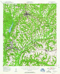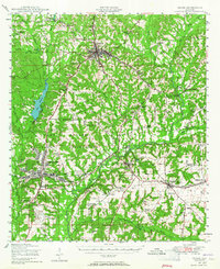
1948 Map of Ozark
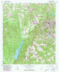
USGS Topo · Published 1965About this map
The Camp Rucker Military Reservation dominates the landscape of Dale County in this postwar era, a period when the installation's footprint profoundly reshaped the surrounding rural communities. The map captures the transition from old milling sites like Marley Mill and Faulks Mill to a modernized infrastructure focused on military readiness, centered around Camp Rucker and the Ozark Airfield. The Atlantic Coast Line railroad provides the primary industrial artery, connecting established towns like Ozark, Newton, and Pinckard to the wider region.
Find a feature on this map
60 named features on this map. Tap any name to fly to it.
Don’t see what you’re looking for? This feature index may not catch every label — zoom into the map to look around manually.
Map Details
Editions of this 1948 Ozark Map
This is the sole edition of this map. No revisions or reprints were ever made.
Historical Maps of Dothan Through Time
8 maps found