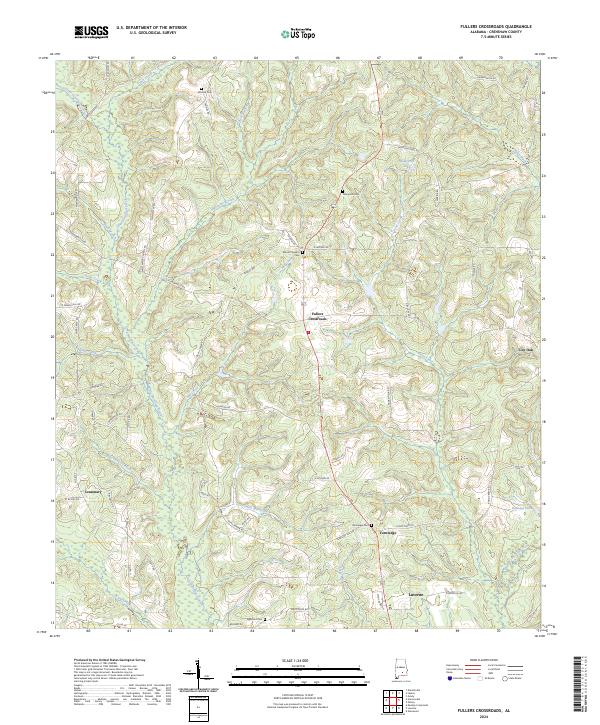
2024 Map of Fullers Crossroads
USGS Topo · Published 2024About this map
Fullers Crossroads and the surrounding rural communities of northern Crenshaw County are defined by a dense network of watercourses and family-named landmarks. The landscape is carved by Little Patsaliga Creek and Patsaliga Creek, with numerous smaller tributaries like Sweetwater Creek and Mill Creek feeding into the drainage system. This area retains its agrarian character, highlighted by the Farm Service Agency Interest of Alabama tract. Genealogists will find several burial sites scattered across the township lines, including Mitchell Cem, Thompson Cem, and Mount Pleasant Cem. The map tracks the transition from the upland crossroads at Vernledge toward the northern reaches of Luverne, showing the persistence of local connectors like Honoraville Rd and Sweetwater Church Rd that have served these timbered and farmed ridges for generations.
Find a feature on this map
74 named features on this map. Tap any name to fly to it.
Don’t see what you’re looking for? This feature index may not catch every label — zoom into the map to look around manually.
Map Details
Editions of this 2024 Fullers Crossroads Map
This is the sole edition of this map. No revisions or reprints were ever made.
Other maps of this area

1953 · Andalusia
USGS Topo · 1:250,000

1957 · Andalusia
USGS Topo · 1:250,000

1968 · Glenwood
USGS Topo · 1:24,000

1968 · Petrey
USGS Topo · 1:24,000

1968 · Grady
USGS Topo · 1:24,000

1971 · Luverne
USGS Topo · 1:24,000

1971 · Fullers Crossroads
USGS Topo · 1:24,000

1971 · Honoraville
USGS Topo · 1:24,000

1971 · Moodys Crossroads
USGS Topo · 1:24,000

1971 · Danielsville
USGS Topo · 1:24,000