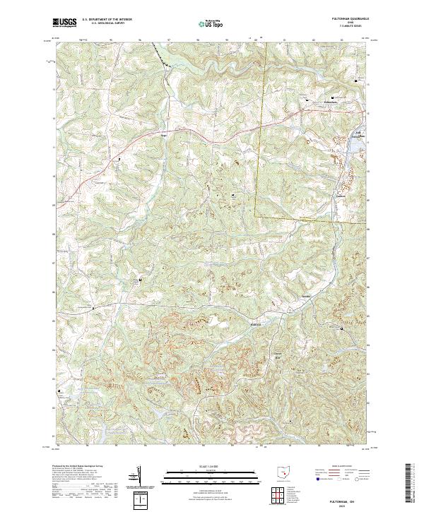
2023 Map of Fultonham
USGS Topo · Published 2023About this map
Jonathan Creek and Bush Creek wind through the borderlands of Muskingum and Perry Counties, defining a landscape marked by established rural settlements and significant water management projects. The village of Fultonham serves as a local hub near East Fultonham, while smaller communities like Sego, Saltillo, and Redfield are scattered across the terrain. For genealogists, the map is particularly detailed, identifying numerous burial sites including Uniontown Cem, Fultonham Cem, and the Unity Presbyterian Cem.
Find a feature on this map
104 named features on this map. Tap any name to fly to it.
Don’t see what you’re looking for? This feature index may not catch every label — zoom into the map to look around manually.
Map Details
Editions of this 2023 Fultonham Map
This is the sole edition of this map. No revisions or reprints were ever made.
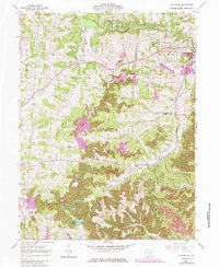
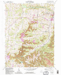
Historical Maps of Fultonham Through Time
3 maps found