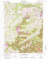
1961 Map of Fultonham
USGS Topo · Published 1985About this map
Perry State Forest occupies a large portion of the southern landscape on this topographic survey, highlighting an area transformed by extensive resource extraction. The 1983 revisions, noted in purple, reveal the expansion of a Strip Mine and other industrial changes that overlay the older agricultural and settlement patterns. The map documents the close-knit communities of Fultonham, East Fultonham, and Saltillo along the border of Perry and Muskingum Counties, where family-named landmarks like Uniontown Cem and Wesley Chapel serve as anchors for genealogical research. Waterways like Jonathan Creek and Butcherknife Creek carve through the terrain, which is also marked by an Abandoned railroad line and a prominent Pipeline, illustrating the shifting infrastructure of the mid-20th century. Local social life is evidenced by the Grange Hall and Townhall, standing as civic centerpieces for the rural townships of Madison and Newton.
Find a feature on this map
40 named features on this map. Tap any name to fly to it.
Don’t see what you’re looking for? This feature index may not catch every label — zoom into the map to look around manually.
Map Details
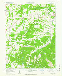
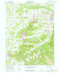
Editions of this 1961 Fultonham Map
Other maps of this area

1907 · Logan
USGS Topo · 1:62,500

1909 · Thornville
USGS Topo · 1:62,500

1909 · Logan
USGS Topo · 1:62,500

1910 · Zanesville
USGS Topo · 1:62,500

1911 · New Lexington
USGS Topo · 1:62,500

1947 · Columbus
USGS Topo · 1:250,000

1961 · Columbus
USGS Topo · 1:250,000

1961 · New Lexington
USGS Topo · 1:24,000

1961 · Deavertown
USGS Topo · 1:24,000

1961 · Zanesville West
USGS Topo · 1:24,000