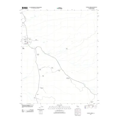
2012 Map of Furnace Creek
USGS Topo · Published 2012About this map
Indian Village and Furnace Creek Ranch sit at the heart of this desert landscape, where water sources like Travertine Springs and Texas Springs dictate the patterns of human activity. The map traces the rugged drainage of the Furnace Cr Wash as it cuts through dramatic geological formations. Industrial history is etched into the terrain at the Harmony Borax Works near the Furnace Creek Golf Course, marking the legacy of mineral extraction in this environment. The eastern portion of the sheet is dominated by complex topography, including the winding paths of Twenty Mule Team Canyon and Echo Canyon. Prominent landmarks such as Manly Beacon, Zabriskie Point, and Mushroom Rock provide navigational anchors for researchers studying the landforms and travel routes of this iconic region.
Find a feature on this map
29 named features on this map. Tap any name to fly to it.
Don’t see what you’re looking for? This feature index may not catch every label — zoom into the map to look around manually.
Map Details
Editions of this 2012 Furnace Creek Map
This is the sole edition of this map. No revisions or reprints were ever made.
Other maps of this area

1908 · Furnace Creek
USGS Topo · 1:250,000

1910 · Furnace Creek
USGS Topo · 1:250,000

1942 · Bullfrog
USGS Topo · 1:125,000

1948 · Death Valley
USGS Topo · 1:250,000

1952 · Chloride Cliff
USGS Topo · 1:50,000

1952 · Furnace Creek
USGS Topo · 1:62,500

1952 · Ryan
USGS Topo · 1:62,500

1952 · Big Dune
USGS Topo · 1:62,500

1954 · Death Valley
USGS Topo · 1:250,000

1956 · Death Valley
USGS Topo · 1:250,000