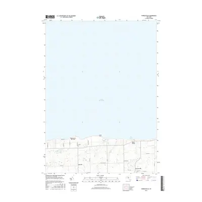
2016 Map of Furnaceville
USGS Topo · Published 2016About this map
The southern shoreline of Lake Ontario defines this portion of Wayne County, where the terrain transitions from the water's edge at Smoky Point into a series of small coastal settlements. The namesake hamlet of Furnaceville and its associated Furnaceville Cem lie inland, connected to the lakefront by a network of local roads like Fisher Rd and Brick Church Rd. Further west, the residential patterns of Lakeside and Ontario on the Lake illustrate the development of the lakefront, while the small Lakeside Cem serves as a reminder of the area's longer settlement history. Several small waterways, including Deer Cr, Mill Cr, and Bear Creek, drain the interior landscape toward the lake, with Bear Creek Harbor providing a focal point for maritime access on the eastern edge of the survey.
Find a feature on this map
28 named features on this map. Tap any name to fly to it.
Don’t see what you’re looking for? This feature index may not catch every label — zoom into the map to look around manually.
Map Details
Editions of this 2016 Furnaceville Map
This is the sole edition of this map. No revisions or reprints were ever made.
Other maps of this area

1899 · Palmyra
USGS Topo · 1:62,500

1900 · Macedon
USGS Topo · 1:62,500

1902 · Pultneyville
USGS Topo · 1:62,500

1902 · Palmyra
USGS Topo · 1:62,500

1932 · Webster
USGS Topo · 1:24,000
1934 · Ninemile Point
USGS Topo · 1:24,000

1934 · Webster
USGS Topo · 1:24,000

1942 · Ontario
USGS Topo · 1:31,680

1942 · Pultneyville
USGS Topo · 1:31,680

1943 · Williamson
USGS Topo · 1:31,680