Old Maps of Wayne County, New York
Explore 164 old maps of Wayne County, spanning from 1899 to today. These high-resolution historic maps reveal how streets, neighborhoods, landmarks, and natural features evolved over time — perfect for genealogy, metal detecting, research, and local history exploration.
What you can do with these maps:
- See how Wayne County changed over time: Compare historical maps to modern-day views to trace roads, homesites, rail lines & more.
- View detailed metadata: Each map includes creators, publishers, year, scale, and archive source.
- Overlay maps with satellite & LiDAR: Visualize the past alongside modern tools to explore terrain & human change.
- Trusted historical sources: Maps sourced from the USGS, Library of Congress, and other archives.
- Access maps your way: View online, download high-res files, or order prints for personal or research use.
Start exploring old maps of Wayne County to uncover forgotten places, hidden landmarks, and the deep history beneath your feet.
Wayne County, NY maps
(164)- 1899 Map of Palmyra, 1956 Print
 1899 Palmyra1956 Print · USGSWayne County is shown here at the turn of the century, characterized by a unique landscape of glacial hills and a bustling canal-and-rail corridor. Researchers can trace the early paths of the Barge Canal and locate landmarks like Mormon Hill and Pigeon Hill.2 unique versions available
 - 1900 Map of Macedon
 1900 Macedon1900 Print · USGSMonroe and Wayne counties thrive at the intersection of water and rail transport at the end of the nineteenth century. Genealogists and historians can trace the original paths of the Erie Canal and locate long-standing settlements like Despatch, Fairport, and Webster.8 unique versions available
 - 1900 Map of Oswego
 1900 Oswego1900 Print · USGSThe Lake Ontario shoreline in Oswego and Cayuga Counties at the turn of the century is a hub of maritime and rail commerce. Genealogists and historians can trace the paths of four major railroads serving lakefront communities like North Fairhaven and the historic grounds of Fort Ontario.8 unique versions available
 - 1902 Map of Sodus Bay
 1902 Sodus Bay1902 Print · USGSThe Wayne County shoreline at the start of the twentieth century reveals a landscape of maritime navigation and glacial landforms. Trace the historic harbor at Sodus Point, locate the Big Sodus L.H., and explore the islands of Bute I. and Islay I.7 unique versions available
 - 1902 Map of Pultneyville
 1902 Pultneyville1902 Print · USGSWayne County's lakefront comes to life in this turn-of-the-century survey of the Pultneyville harbor and surrounding orchards. Trace the early transport lines of the Electric R. R. and coastal landmarks like Fairbanks Pt. along Lake Ontario.5 unique versions available
 - 1902 Map of Clyde
 1902 Clyde1902 Print · USGSUpper New York state at the turn of the century shows a dense network of competing rail and water routes. Trace the path of the Erie Canal and find defunct stretches like the Erie Canal (Abandoned) alongside the Clyde River.8 unique versions available
 - 1902 Map of Weedsport
 1902 Weedsport1902 Print · USGSCentral New York at the turn of the century reveals a landscape shaped by the Erie Canal and a dense network of early railroads. Genealogists and historians can trace the foundations of Weedsport and Port Byron, or locate landmarks like the Brick Church and the Canal Basin at Montezuma.10 unique versions available
 - 1902 Map of Palmyra
 1902 Palmyra1902 Print · USGSCentral Wayne County at the turn of the century shows a landscape defined by the Erie Canal and a dense network of early railroads. Genealogists can trace family names and small hamlets from Mormon Hill to the busy canal docks at Newark and Port Gibson.7 unique versions available
 - 1932 Map of Webster
 1932 Webster1932 Print · USGSMonroe County settlements and rural school districts are captured here in the early 1930s. Genealogists can locate specific farm-to-market routes and historic landmarks like Thousand Acre Swamp, West Webster, and the New York Central RR.
 - 1934 Map of Ninemile Point
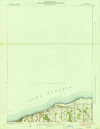 1934 Ninemile Point1934 Print · USGSCoastal Monroe County is captured here in the early thirties as the township of Webster developed along the lake. Genealogists and local researchers can locate Union Cem, School No 9, and old family routes like Salt Road.2 unique versions available
 - 1934 Map of Webster
 1934 Webster1934 Print · USGSMonroe County was a landscape of thriving orchards and rural school districts in the early thirties. Genealogists can locate family homesteads near Thousand Acre Swamp or trace the origins of West Webster and Penfield along the Ridge Road State Highway.3 unique versions available
 - 1942 Map of Ontario
 1942 Ontario1942 Print · USGSWayne County just before the mid-century shows a landscape of busy hamlets and extensive orchards linked by a network of numbered schools. Researchers can trace the New York Central Railroad corridor and locate ancestral sites like Dixon Cem and Fruitland.
 - 1942 Map of Pultneyville
 1942 Pultneyville1942 Print · USGSThe Lake Ontario shoreline in Wayne County is captured here just before the mid-century, showing the orchards and lakefront landings of Williamson. Trace family roots and land plots near Pultneyville, Lakeview Cem, and School No 3.
 - 1943 Map of Lyons
 1943 Lyons1943 Print · USGSThe village of Lyons and its neighboring hamlets are captured in the early 1940s during a period of transition for the historic Erie Canal. Researchers can trace old family sites at Fergusons Corners, local schoolhouses, and several burial grounds including Rural Cem.
 - 1943 Map of Montezuma
 1943 Montezuma1943 Print · USGSThe Cayuga County marshlands are captured here during the Second World War as the region’s massive river and canal systems were being managed for conservation. You can trace the early path of the Erie Canal (Abandoned) or find family sites near Port Byron and Murray Cem.
 - 1943 Map of Williamson
 1943 Williamson1943 Print · USGSWayne County’s orchard country and glacial drumlins are captured in detail during the early 1940s. Genealogists and local researchers can trace historic property boundaries and family landmarks like Hall Center Cem, Owls Nest, and Cory Corners.
 - 1943 Map of Sodus Point
 1943 Sodus Point1943 Print · USGSWayne County's Lake Ontario shoreline is captured here during the 1940s, highlighting the area's transition from a rail-to-water shipping hub to a summer retreat. Genealogists can locate School No 13 and St Johns Fishers Chapel or trace the Pennsylvania rail line into Sodus Point.
 - 1943 Map of Savannah
 1943 Savannah1943 Print · USGSThe marshlands and waterways of Wayne County are captured here in the 1940s, highlighting the vital corridor of the Erie Canal and Clyde River. Family historians can trace old homesteads near Hunt Corners, Lockpit Cem, and several numbered schoolhouses.
 - 1943 Map of Sodus
 1943 Sodus1943 Print · USGSWayne County farming and rail transport are captured here during the war years, showcasing a dense network of district schoolhouses. Genealogists can trace family lands near Sodus Center, the Lime Kiln, and vanished rural stops like Minsteed.
 - 1943 Map of Fair Haven
 1943 Fair Haven1943 Print · USGSThe Lake Ontario shoreline in Cayuga and Wayne Counties during the mid-1940s reveals a landscape of bays, orchards, and rural school districts. Genealogists can trace family names at Springbrook Cem or locate old rail stops at Sterling Junction and Crocketts.2 unique versions available
 - 1943 Map of Wolcott
 1943 Wolcott1943 Print · USGSWayne County farming communities thrive in the early 1940s, connected by a network of rural roads and small hamlets. Genealogists can trace family roots through numerous sites like Sunnyside Church, Butler Savannah Cem, and Maunders Corners.
 - 1943 Map of Newark
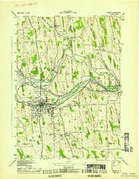 1943 Newark1943 Print · USGSWayne County's canal and rail corridor is captured here during the Second World War, showing the critical junction at Newark. Genealogists and historians can trace the Newark State School, the Abd Erie Canal, and old rural landmarks like Mud Mills or Old Houser Cem.
 - 1943 Map of Rose
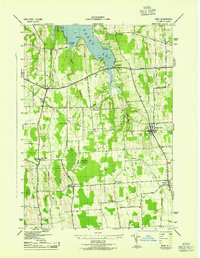 1943 Rose1943 Print · USGSMid-century Wayne County agriculture and shoreline living are on display in this survey of the eastern Sodus Bay region. Genealogists can locate family homesteads near York Settlement, Barton Cem, and numerous district schools like School No 16.
 - 1943 Map of Red Creek
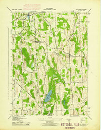 1943 Red Creek1943 Print · USGSUpper New York state during the early 1940s shows a landscape of small farming hamlets and rural school districts along the Wayne and Cayuga county line. Researchers can trace historic cemeteries like French Cem, early landmarks like the Airport, and old district schoolhouses.
 - 1943 Map of North Wolcott
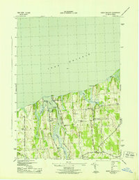 1943 North Wolcott1943 Print · USGSCoastal Wayne County during the mid-war years is mapped here in detail, showing the deep inlets of the Lake Ontario shoreline and the rural school districts of the interior. Genealogists can trace family lands near North Wolcott, Desbrough Park, or the historic Park Cem.
Showing maps 1-25 of 164
Top cities of Wayne County
- Arcadia historical maps
- Ontario historical maps
- Macedon historical maps
- Walworth historical maps
- Sodus historical maps
- Palmyra historical maps
See more
Frequently asked questions
- What are the different types of historical maps available for Wayne County?
- What is the oldest map of Wayne County?
- Where can I purchase historical maps of Wayne County for my home or office?
- Where can I download high-res historical maps of Wayne County?
- Are there historical topographic maps available for Wayne County?
- Is there historical aerial imagery available for Wayne County?
- Where are historical maps of Wayne County sourced from?