Old Maps of Wayne County, New York for Hiking & Exploration
Hike through history with 80 historic maps of Wayne County. Explore old trails, ghost towns, and forgotten backroads — perfect for outdoor adventurers and local explorers.
- Rediscover forgotten places: Map out old mining camps, roads, and footpaths that no longer exist on modern maps.
- Layer with modern tools: Combine with LiDAR or satellite views to plan hikes through historical terrain.
- Made for exploration: Popular among hikers, overlanders, and local history lovers.
Use these maps to find adventure and explore the hidden past of Wayne County.
Wayne County, NY maps
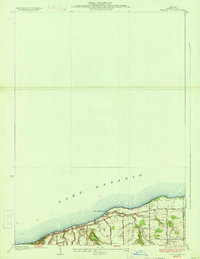
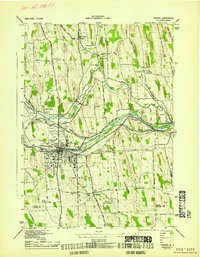
(80)- 1899 Map of Palmyra, 1956 Print
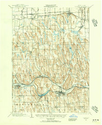 1899 Palmyra1956 Print · USGSCovers Wayne County, including Farmington, Arcadia, and other nearby areas2 unique versions available
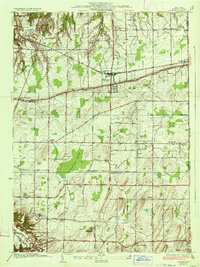
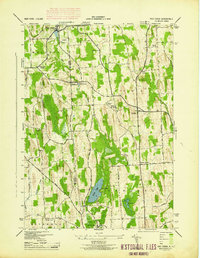
 - 1900 Map of Macedon
 1900 Macedon1900 Print · USGSCovers Wayne County, including Perinton, Webster, and other nearby areas8 unique versions available
 - 1900 Map of Oswego
 1900 Oswego1900 Print · USGSCovers Wayne County, including Oswego, Oswego, and other nearby areas8 unique versions available
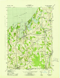
 - 1902 Map of Sodus Bay
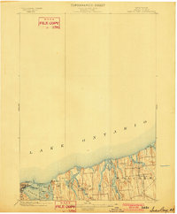 1902 Sodus Bay1902 Print · USGSCovers Wayne County, including Sodus, Wolcott, and other nearby areas7 unique versions available
 - 1902 Map of Pultneyville
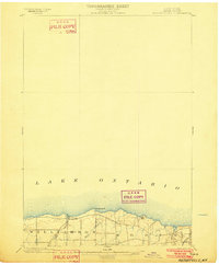 1902 Pultneyville1902 Print · USGSCovers Wayne County, including Sodus, Williamson, and other nearby areas5 unique versions available
 - 1902 Map of Clyde
 1902 Clyde1902 Print · USGSCovers Wayne County, including Sodus, Phelps, and other nearby areas8 unique versions available
 - 1902 Map of Weedsport
 1902 Weedsport1902 Print · USGSCovers Wayne County, including Brutus, Wolcott, and other nearby areas10 unique versions available
 - 1902 Map of Palmyra
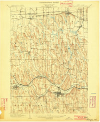 1902 Palmyra1902 Print · USGSCovers Wayne County, including Farmington, Arcadia, and other nearby areas7 unique versions available
 - 1932 Map of Webster
 1932 Webster1932 Print · USGSCovers Wayne County, including Webster, Penfield, and other nearby areas
 - 1934 Map of Ninemile Point
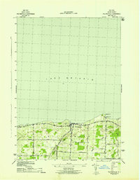
 1934 Ninemile Point1934 Print · USGSCovers Wayne County, including Webster, Ontario, and other nearby areas2 unique versions available
 - 1934 Map of Webster
 1934 Webster1934 Print · USGSCovers Wayne County, including Webster, Penfield, and other nearby areas3 unique versions available
 - 1942 Map of Ontario
 1942 Ontario1942 Print · USGSCovers Wayne County, including Penfield, Ontario, and other nearby areas
 - 1942 Map of Pultneyville
 1942 Pultneyville1942 Print · USGSCovers Wayne County, including Sodus, Williamson, and other nearby areas
 - 1943 Map of Lyons
 1943 Lyons1943 Print · USGSCovers Wayne County, including Phelps, Lyons, and other nearby areas
 - 1943 Map of Montezuma
 1943 Montezuma1943 Print · USGSCovers Wayne County, including Mentz, Throop, and other nearby areas
 - 1943 Map of Williamson
 1943 Williamson1943 Print · USGSCovers Wayne County, including Arcadia, Sodus, and other nearby areas
 - 1943 Map of Sodus Point
 1943 Sodus Point1943 Print · USGSCovers Wayne County, including Sodus, Huron, and other nearby areas
 - 1943 Map of Savannah
 1943 Savannah1943 Print · USGSCovers Wayne County, including Galen, Clyde, and other nearby areas
 - 1943 Map of Sodus
 1943 Sodus1943 Print · USGSCovers Wayne County, including Arcadia, Sodus, and other nearby areas
 - 1943 Map of Fair Haven
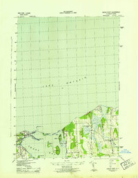
 1943 Fair Haven1943 Print · USGSCovers Wayne County, including Wolcott, Sterling, and other nearby areas2 unique versions available
 - 1943 Map of Wolcott
 1943 Wolcott1943 Print · USGSCovers Wayne County, including Galen, Wolcott, and other nearby areas
 - 1943 Map of Newark
 1943 Newark1943 Print · USGSCovers Wayne County, including Arcadia, Newark, and other nearby areas
 - 1943 Map of Rose
 1943 Rose1943 Print · USGSCovers Wayne County, including Sodus, Lyons, and other nearby areas
 - 1943 Map of Red Creek
 1943 Red Creek1943 Print · USGSCovers Wayne County, including Wolcott, Sterling, and other nearby areas
 - 1943 Map of North Wolcott
 1943 North Wolcott1943 Print · USGSCovers Wayne County, including Wolcott, Huron, and other nearby areas
Showing maps 1-25 of 80
Top cities of Wayne County
- Arcadia historical maps
- Ontario historical maps
- Macedon historical maps
- Walworth historical maps
- Sodus historical maps
- Palmyra historical maps
See more
Frequently asked questions
- What are the different types of historical maps available for Wayne County?
- What is the oldest map of Wayne County?
- Where can I purchase historical maps of Wayne County for my home or office?
- Where can I download high-res historical maps of Wayne County?
- Are there historical topographic maps available for Wayne County?
- Is there historical aerial imagery available for Wayne County?
- Where are historical maps of Wayne County sourced from?