2020s Maps of Wayne County, New York
Explore 21 historic maps of Wayne County from the 2020s. These maps offer a rare glimpse into what life looked like during the 2020s — showing old roads, neighborhoods, homes, and landmarks that have changed or disappeared over time.
Whether you're researching your family's past, planning a metal detecting trip, or studying how Wayne County's landscape evolved across the 2020s, these high-resolution maps are a powerful tool for exploring the history of this region.
- Focus on a specific era: All maps on this page are from the 2020s, giving you a focused view of this time period.
- See what’s changed: Compare century-old streets, trails, and buildings to today's modern landscape using overlays and satellite layers.
- Research with precision: Use these maps for genealogy, historical research, land use analysis, or educational projects.
- View, download, or print: Maps are fully viewable online in high resolution, and can be downloaded or printed for your own records.
Start exploring Wayne County's history through authentic maps from the 2020s. This is your window into the past.
Wayne County, NY maps
(21)- 2023 Map of Sodus, 2023 Print
 2023 Sodus2023 Print · USGSWayne County orchards and drumlin fields define this landscape as it appeared in the 2020s. Genealogists can trace family burial sites from Sodus Rural Cem to the Kitchen Burial Plot, while exploring historic hamlets like Wallington and Sodus Center.
 - 2023 Map of Macedon, 2023 Print
 2023 Macedon2023 Print · USGSWayne County’s canal corridor is documented here in the early twenty-first century, showing the enduring influence of the Erie Canal on local geography. Genealogists and historians can locate legacy sites like the Union Burying Ground, Yellow Mills, and the North Farmington Friends Cem.
 - 2023 Map of Williamson, 2023 Print
 2023 Williamson2023 Print · USGSWayne County’s agricultural heartland and glacial drumlins are captured here in the twenty-first century. Researchers can trace historic family burial sites at Ridge Chapel Cem and Hall Center Cem or locate the settlements of Marion and Owls Nest.
 - 2023 Map of Newark, 2023 Print
 2023 Newark2023 Print · USGSWayne County’s canal-side heritage remains visible in this contemporary survey of the corridor between Newark and Lyons. Researchers can trace old township burial grounds like Silver Hill Marbletown Cem and locate historic hamlets such as Mud Mills and Hydesville.
 - 2023 Map of Lyons, 2023 Print
 2023 Lyons2023 Print · USGSWayne County's agricultural heartland and canal heritage are visible in this detailed survey, centered on the historic village of Lyons. Researchers can trace old transportation corridors along the Erie Canal or locate local landmarks like Lock Berlin, Alloway, and several cemeteries including Oak Hill Cem.
 - 2023 Map of Victory, 2023 Print
 2023 Victory2023 Print · USGSVictory and the rural borderlands of Wayne and Cayuga counties are shown in this 2023 survey. Researchers can trace land use around Duck Lake and locate several burial sites including Victory Union Cem and Spring Lake Cem.
 - 2023 Map of Sodus Point, 2023 Print
 2023 Sodus Point2023 Print · USGSThe Lake Ontario shoreline in Wayne County shows a landscape of deep bays and islands as it appeared in 2023. Trace the coastal developments from Sodus Point to the dramatic formations at Chimney Bluff and the quiet waters of East Bay.
 - 2023 Map of North Wolcott, 2023 Print
 2023 North Wolcott2023 Print · USGSThe Lake Ontario shoreline in Wayne County is captured here in modern detail, from the drumlins to the sheltered waters of Port Bay. Genealogists can locate family names at North Wolcott Cem and Joiner Cem or trace the lands around Desbrough Park.
 - 2023 Map of West Ninemile Point, 2023 Print
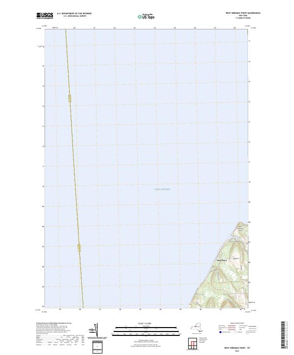 2023 West Ninemile Point2023 Print · USGSThe Lake Ontario shoreline at the Cayuga and Wayne county line is captured in this modern survey. Genealogists and local historians can trace lakeside properties near Moon Beach and the mouth of Ninemile Creek at West Ninemile Point.
 - 2023 Map of Savannah, 2023 Print
 2023 Savannah2023 Print · USGSThe village of Clyde and the crossroads at Savannah are shown alongside the modern path of the Erie Canal. Genealogists and researchers can locate family landmarks like Lockpit Cem, the Harvey Cem, and the historic route of Clintons Ditch.
 - 2023 Map of Montezuma, 2023 Print
 2023 Montezuma2023 Print · USGSSettlement in Cayuga County centered on the vital corridors of the Erie Canal and the Seneca River during this era of rural development. Local researchers can trace family plots at Montezuma Rural Cem or locate old transit points like Fox Ridge.
 - 2023 Map of Rose, 2023 Print
 2023 Rose2023 Print · USGSWayne County's rural landscape meets the southern edge of the Great Lakes in the early twenty-first century. Genealogists and historians can trace local family lineages through York Settlement Cem, South Sodus Cem, and the marshy expanses of Huckleberry Swamp.
 - 2023 Map of Wolcott, 2023 Print
 2023 Wolcott2023 Print · USGSWayne County’s agricultural heartland is documented here in the early twenty-first century, showing a landscape of drumlins and creek valleys. Genealogists can locate several family burial grounds, including Roe Cem, Sprague Cem, and the Hunt Corners Cem.
 - 2023 Map of Ontario, 2023 Print
 2023 Ontario2023 Print · USGSWayne County's agricultural and residential corridors are mapped in the early 2020s, showing the evolved landscape from Union Hill to Walworth. Trace family history and local landmarks through sites like West Walworth Cem, Negro Hill, and the crossroads at Lincoln.
 - 2023 Map of Pultneyville, 2023 Print
 2023 Pultneyville2023 Print · USGSThe Lake Ontario shoreline near Pultneyville comes into focus in this contemporary survey of Wayne County. Genealogists and local historians can trace family land along Stoney Lonesome Rd or locate records at Lakeview Cem and Salmon Creek.
 - 2023 Map of Furnaceville, 2023 Print
 2023 Furnaceville2023 Print · USGSThe Wayne County shoreline meets the Great Lakes in the early 2020s, revealing a landscape of coastal settlements and inland hamlets. Trace family histories at Lakeside Cem and Furnaceville Cem or explore the drainage of Bear Creek.
 - 2023 Map of Salmon Creek, 2023 Print
 2023 Salmon Creek2023 Print · USGSThe Lake Ontario shoreline in Wayne County is captured here in the early twenty-first century, showing the rural character of the Sodus region. Researchers can locate family landmarks like Bushnell Cem and Sodus Fruit Farm or trace the waters of Salmon Creek to Maxwell Bay.
 - 2023 Map of Ninemile Point, 2023 Print
 2023 Ninemile Point2023 Print · USGSThe Lake Ontario shoreline in Monroe County is captured here in recent years, centered on the prominent landmark of Ninemile Point. Researchers can trace the layout of the Webster Union Cem and the small coastal streams like Fourmile Creek and Mill Creek.
 - 2023 Map of Palmyra, 2023 Print
 2023 Palmyra2023 Print · USGSThe Erie Canal corridor comes to life in this recent study of the Wayne County landscape. Genealogists can trace family plots at Palmyra Cem or Gibson Rural Cem, while canal buffs can follow the path of The Wide Waters.
 - 2023 Map of Webster, 2023 Print
 2023 Webster2023 Print · USGSMonroe County enters the 2020s as a blend of established residential neighborhoods and significant natural preserves. Genealogists can locate several historic burial grounds, from the Pioneer Burial Ground to the Webster Rural Cem and Oakwood Cem.
 - 2023 Map of Fair Haven, 2023 Print
 2023 Fair Haven2023 Print · USGSThe Lake Ontario shoreline near Fair Haven comes alive in this survey of its harbors and hamlets. Researchers can map out ancestral sites at Livingston Cem and Martville Cem or trace the drainage of Sterling Creek from the village of Sterling to the Great Lake.
End of results
Showing maps 1-21 of 21
Top cities of Wayne County
- Arcadia historical maps
- Ontario historical maps
- Macedon historical maps
- Walworth historical maps
- Sodus historical maps
- Palmyra historical maps
See more
Frequently asked questions
- What are the different types of historical maps available for Wayne County?
- What is the oldest map of Wayne County?
- Where can I purchase historical maps of Wayne County for my home or office?
- Where can I download high-res historical maps of Wayne County?
- Are there historical topographic maps available for Wayne County?
- Is there historical aerial imagery available for Wayne County?
- Where are historical maps of Wayne County sourced from?