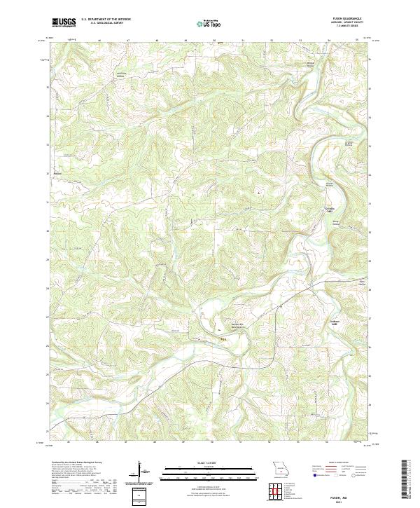
2021 Map of Fuson
USGS Topo · Published 2021About this map
The Gasconade River winds through this section of Wright County, carving a landscape defined by deep hollows and unique geological formations. The Needles Eye Natural Arch stands as a prominent landmark overlooking the river valley, while the small settlement of Fuson anchors the western portion of the quadrangle. This area was historically shaped by its water resources, as evidenced by the locations of Grimes Mill and Latham Mill, both situated near the banks of the river and its tributaries like Crooked Cr.
Find a feature on this map
61 named features on this map. Tap any name to fly to it.
Don’t see what you’re looking for? This feature index may not catch every label — zoom into the map to look around manually.
Map Details
Editions of this 2021 Fuson Map
This is the sole edition of this map. No revisions or reprints were ever made.
Other maps of this area

1931 · Manes
USGS Topo · 1:48,000

1941 · Manes
USGS Topo · 1:62,500

1943 · Manes
USGS Topo · 1:62,500

1951 · Mountain Grove North
USGS Topo · 1:24,000

1951 · Owens
USGS Topo · 1:24,000

1951 · Mansfield NE
USGS Topo · 1:24,000

1951 · Mountain Grove
USGS Topo · 1:62,500

1954 · Springfield
USGS Topo · 1:250,000
1956 · Hartville
USGS Topo · 1:24,000
1956 · Grovespring
USGS Topo · 1:24,000