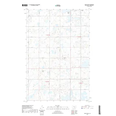
2018 Map of Gackle South
USGS Topo · Published 2018About this map
Gackle sits at the northern edge of this Logan County landscape, a region defined by a high density of prairie potholes and small wetlands. The map reveals a deeply rooted local history through its small family and community burial grounds, including Neudorf Cem in the northwest, Gackle Cem near the town site, and Saari Cem to the southeast. These sites, often located near section corners or along roads like Neu Dorf Rd, provide critical geographic anchors for genealogical research in this part of North Dakota.
Find a feature on this map
27 named features on this map. Tap any name to fly to it.
Don’t see what you’re looking for? This feature index may not catch every label — zoom into the map to look around manually.
Map Details
Editions of this 2018 Gackle South Map
This is the sole edition of this map. No revisions or reprints were ever made.
Other maps of this area

1953 · Jamestown
USGS Topo · 1:250,000

1956 · Jamestown
USGS Topo · 1:250,000

1982 · Fredonia NW
USGS Topo · 1:24,000

1982 · Lehr NE
USGS Topo · 1:24,000

1982 · Fredonia NE
USGS Topo · 1:24,000

1983 · Alfred
USGS Topo · 1:24,000

1983 · Streeter
USGS Topo · 1:24,000

1983 · Gackle North
USGS Topo · 1:24,000

1983 · Streeter SE
USGS Topo · 1:24,000
1983 · Gackle South
USGS Topo · 1:24,000