
1982 Map of Lehr NE
USGS Topo · Published 1983About this map
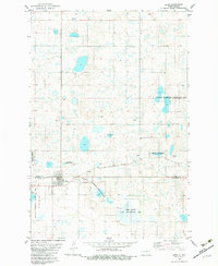
Streeter Moraine defines the undulating topography of this Logan County landscape, a glacial formation marked by a dense concentration of small lakes and seasonal potholes. In the early 1980s, large portions of this territory were managed as the National Waterfowl Production Area, reflecting the region's importance to migratory birds within the Prairie Pothole Region. For those researching local family history, the map identifies King Cem and a second unnamed Cem located south of the main waterfowl production tracts. While the area is largely characterized by conservation and wildlife management, small-scale industrial activity is evidenced by a Gravel Pit, likely used for maintaining the section-line roads that segment the prairie.
Find a feature on this map
6 named features on this map. Tap any name to fly to it.
Don’t see what you’re looking for? This feature index may not catch every label — zoom into the map to look around manually.
Map Details
Editions of this 1982 Lehr NE Map
This is the sole edition of this map. No revisions or reprints were ever made.
Other maps of this area

1953 · Jamestown
USGS Topo · 1:250,000

1956 · Jamestown
USGS Topo · 1:250,000

1982 · Fredonia NW
USGS Topo · 1:24,000

1982 · Guyson
USGS Topo · 1:24,000

1982 · Lehr NW
USGS Topo · 1:24,000

1982 · Lehr SW
USGS Topo · 1:24,000
1982 · Lehr
USGS Topo · 1:24,000

1983 · Streeter SW
USGS Topo · 1:24,000

1983 · Streeter SE
USGS Topo · 1:24,000
1983 · Gackle South
USGS Topo · 1:24,000