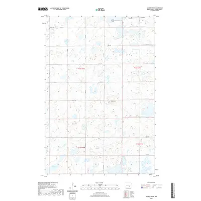
2020 Map of Gackle South
USGS Topo · Published 2020About this map
Gackle sits at the northern edge of this Logan County landscape, a region defined by the intricate prairie pothole topography of central North Dakota. The terrain is densely pocketed with small wetlands and depressions, with larger water bodies like School Lake marking the southern reaches. Elevated landmarks such as Buffalo Hill and Cactus Point rise above the surrounding plains, providing geographical orientation in a landscape dominated by section-line roads like Neu Dorf Rd and 56th St SE.
Find a feature on this map
26 named features on this map. Tap any name to fly to it.
Don’t see what you’re looking for? This feature index may not catch every label — zoom into the map to look around manually.
Map Details
Editions of this 2020 Gackle South Map
This is the sole edition of this map. No revisions or reprints were ever made.
Other maps of this area

1953 · Jamestown
USGS Topo · 1:250,000

1956 · Jamestown
USGS Topo · 1:250,000

1982 · Fredonia NW
USGS Topo · 1:24,000

1982 · Lehr NE
USGS Topo · 1:24,000

1982 · Fredonia NE
USGS Topo · 1:24,000

1983 · Alfred
USGS Topo · 1:24,000

1983 · Streeter
USGS Topo · 1:24,000

1983 · Gackle North
USGS Topo · 1:24,000

1983 · Streeter SE
USGS Topo · 1:24,000
1983 · Gackle South
USGS Topo · 1:24,000