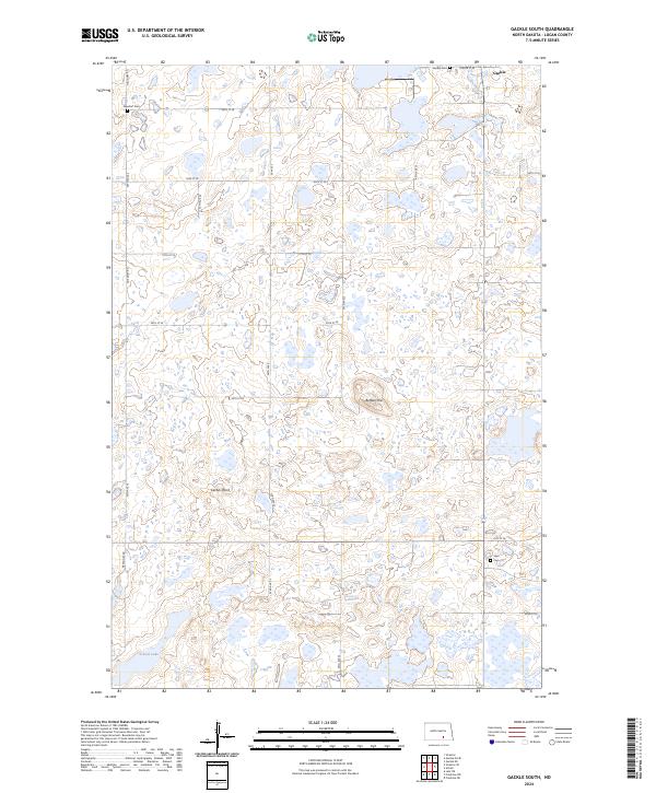
2024 Map of Gackle South
USGS Topo · Published 2024About this map
Gackle sits at the northern edge of this Logan County landscape, serving as a focal point for the surrounding prairie pothole region. This territory is defined by a dense network of small wetlands and marshes, protected in several tracts of the Logan County Waterfowl Production Area. The section-line road system, including routes like Neu Dorf Rd and 55th St SE, grids the undulating terrain marked by elevations such as Buffalo Hill and Cactus Point. For those tracing local roots, several family and community burial sites are preserved here, including Neudorf Cem, Gackle Cem, and Saari Cem. In the southern portion of the map, School Lake stands out as one of the larger permanent water bodies in an area otherwise characterized by ephemeral basins and agricultural fields.
Find a feature on this map
20 named features on this map. Tap any name to fly to it.
Don’t see what you’re looking for? This feature index may not catch every label — zoom into the map to look around manually.
Map Details
Editions of this 2024 Gackle South Map
This is the sole edition of this map. No revisions or reprints were ever made.
Other maps of this area

1953 · Jamestown
USGS Topo · 1:250,000

1956 · Jamestown
USGS Topo · 1:250,000

1982 · Fredonia NW
USGS Topo · 1:24,000

1982 · Lehr NE
USGS Topo · 1:24,000

1982 · Fredonia NE
USGS Topo · 1:24,000

1983 · Alfred
USGS Topo · 1:24,000

1983 · Streeter
USGS Topo · 1:24,000

1983 · Gackle North
USGS Topo · 1:24,000

1983 · Streeter SE
USGS Topo · 1:24,000
1983 · Gackle South
USGS Topo · 1:24,000