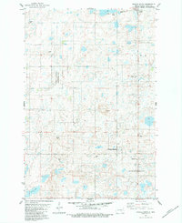
1983 Map of Gackle South
USGS Topo · Published 1983About this map
The prairie landscape of Logan County is defined by its numerous small depressions and sloughs, many of which are protected within the National Waterfowl Production Area. This 1983 survey shows the rural character of the region south of the town of Gackle, where the agricultural economy is punctuated by local infrastructure like Gackle Airport and various Gravel Pits. Significant local landmarks include Buffalo Hill and Cactus Point, which rise above the surrounding terrain and the scattered wetlands.
Find a feature on this map
16 named features on this map. Tap any name to fly to it.
Don’t see what you’re looking for? This feature index may not catch every label — zoom into the map to look around manually.
Map Details
Editions of this 1983 Gackle South Map
This is the sole edition of this map. No revisions or reprints were ever made.
Other maps of this area

1953 · Jamestown
USGS Topo · 1:250,000

1956 · Jamestown
USGS Topo · 1:250,000

1982 · Fredonia NW
USGS Topo · 1:24,000

1982 · Lehr NE
USGS Topo · 1:24,000

1982 · Fredonia NE
USGS Topo · 1:24,000

1983 · Alfred
USGS Topo · 1:24,000

1983 · Streeter
USGS Topo · 1:24,000

1983 · Gackle North
USGS Topo · 1:24,000

1983 · Streeter SE
USGS Topo · 1:24,000
1983 · Gackle NE
USGS Topo · 1:24,000