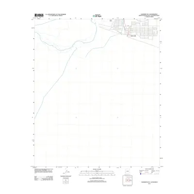
2011 Map of Gadsden OE S
USGS Topo · Published 2011About this map
San Luis sits at the northern edge of this border region, showing a transition from organized residential blocks into the surrounding desert and agricultural reaches of the Yuma Valley. The map details a growing infrastructure at the turn of the decade, with a grid of streets including Escondido St, A St, and Avenue H extending toward the boundary. The path of Sality Canal Rd cuts across the landscape, tracing the vital irrigation routes that support this arid environment. This 2011 survey records the expansion of the town and its road network as it interfaces with the open terrain to the south and west.
Find a feature on this map
6 named features on this map. Tap any name to fly to it.
Don’t see what you’re looking for? This feature index may not catch every label — zoom into the map to look around manually.
Map Details
Editions of this 2011 Gadsden OE S Map
This is the sole edition of this map. No revisions or reprints were ever made.
Other maps of this area

1903 · Yuma
USGS Topo · 1:125,000

1905 · Yuma
USGS Topo · 1:125,000

1940 · Yuma
USGS Topo · 1:62,500

1942 · Yuma
USGS Topo · 1:250,000

1945 · Yuma
USGS Topo · 1:62,500

1954 · El Centro
USGS Topo · 1:250,000

1955 · El Centro
USGS Topo · 1:250,000

1958 · El Centro
USGS Topo · 1:250,000

1961 · El Centro
USGS Topo · 1:250,000

1964 · El Centro
USGS Topo · 1:250,000