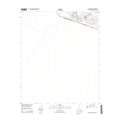
2014 Map of Gadsden OE S
USGS Topo · Published 2014About this map
The international border between the United States of America and Mexico bisects this desert landscape, where the agricultural flats of the Yuma Valley meet the expanding urban grid of San Luis. This 2014 survey captures the precise street network of this border community during a period of significant growth, showing residential and commercial blocks reaching toward the limit of Yuma County. The map reveals a densely planned townsite defined by thoroughfares such as N Cesar Chavez St and E Juan Sanchez Blvd, illustrating how political boundaries and irrigation-fed agriculture shape the development patterns of the Arizona-Sonora frontier.
Find a feature on this map
42 named features on this map. Tap any name to fly to it.
Don’t see what you’re looking for? This feature index may not catch every label — zoom into the map to look around manually.
Map Details
Editions of this 2014 Gadsden OE S Map
This is the sole edition of this map. No revisions or reprints were ever made.
Other maps of this area

1903 · Yuma
USGS Topo · 1:125,000

1905 · Yuma
USGS Topo · 1:125,000

1940 · Yuma
USGS Topo · 1:62,500

1942 · Yuma
USGS Topo · 1:250,000

1945 · Yuma
USGS Topo · 1:62,500

1954 · El Centro
USGS Topo · 1:250,000

1955 · El Centro
USGS Topo · 1:250,000

1958 · El Centro
USGS Topo · 1:250,000

1961 · El Centro
USGS Topo · 1:250,000

1964 · El Centro
USGS Topo · 1:250,000