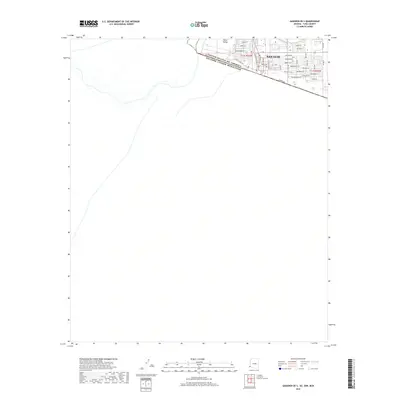
2018 Map of Gadsden OE S
USGS Topo · Published 2018About this map
San Luis stands as the primary urban center in this 2018 survey, situated directly along the international boundary in the Yuma Valley. This border region is defined by the heavy diagonal of the United States of America Estados Unidos Mexicanos line, which separates the organized street grid of the American settlement from the open terrain to the south. The city's growth is mapped through a dense network of residential and commercial thoroughfares, including Cesar Chavez St, San Luis Plaza Dr, and numerous avenues extending toward the eastern desert. Agricultural or industrial transit is evidenced by the Sality Canal Rd running parallel to the border. This map provides a clear look at the modern layout of this critical port of entry, tracing the local infrastructure from Aquila St in the north to the residential developments along Urtuzuastegui St.
Find a feature on this map
40 named features on this map. Tap any name to fly to it.
Don’t see what you’re looking for? This feature index may not catch every label — zoom into the map to look around manually.
Map Details
Editions of this 2018 Gadsden OE S Map
This is the sole edition of this map. No revisions or reprints were ever made.
Other maps of this area

1903 · Yuma
USGS Topo · 1:125,000

1905 · Yuma
USGS Topo · 1:125,000

1940 · Yuma
USGS Topo · 1:62,500

1942 · Yuma
USGS Topo · 1:250,000

1945 · Yuma
USGS Topo · 1:62,500

1954 · El Centro
USGS Topo · 1:250,000

1955 · El Centro
USGS Topo · 1:250,000

1958 · El Centro
USGS Topo · 1:250,000

1961 · El Centro
USGS Topo · 1:250,000

1964 · El Centro
USGS Topo · 1:250,000