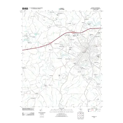
2011 Map of Gaffney
USGS Topo · Published 2011About this map
Gaffney serves as the central hub of this Cherokee County study, surrounded by a dense network of suburban developments such as Wellington Manor, Belmont Acres, and Harmony Hill. The landscape is defined by the headwaters of Thicketty Creek and the significant reservoir of Lake Whelchel to the northeast. A high concentration of family-named burial grounds and community landmarks suggests a deep-rooted local history, with Fairview, Providence, and Byars cemeteries scattered across the outskirts. The infrastructure is anchored by the Gaffney Post Office and local gathering spots like the Gaffney Memorial Park. Natural springs, including Lipscombe Spring and Limestone Spring, highlight the area's geological character, while numerous small dams and reservoirs such as Shrine Club Lake Dam D-3415 point to managed water resources supporting the growing residential corridors of the early 21st century.
Find a feature on this map
245 named features on this map. Tap any name to fly to it.
Don’t see what you’re looking for? This feature index may not catch every label — zoom into the map to look around manually.
Map Details
Editions of this 2011 Gaffney Map
This is the sole edition of this map. No revisions or reprints were ever made.
Other maps of this area

1909 · Gaffney
USGS Topo · 1:62,500

1941 · Spartanburg
USGS Topo · 1:250,000

1947 · Spartanburg
USGS Topo · 1:62,500

1949 · Spartanburg
USGS Topo · 1:62,500

1953 · Spartanburg
USGS Topo · 1:250,000

1953 · Charlotte
USGS Topo · 1:250,000

1954 · Charlotte
USGS Topo · 1:250,000

1959 · Cowpens
USGS Topo · 1:62,500

1960 · Charlotte
USGS Topo · 1:250,000

1960 · Spartanburg
USGS Topo · 1:250,000