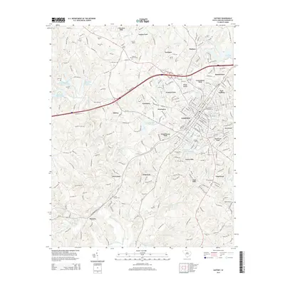
2014 Map of Gaffney
USGS Topo · Published 2014About this map
Gaffney serves as the focal point of this Cherokee County landscape, where the traditional textile and education hub is surrounded by a dense network of suburban developments like Westerly Park, Forest Hills, and East Gaffney. The presence of Limestone Coll and the expansive Gaffney Memorial Park highlight the town's established institutional core. The surrounding terrain is defined by the prominent Thicketty Mountain to the west and the waters of Lake Whelchel to the northeast, with numerous small creeks such as Cherokee Cr and Thicketty Cr draining the land.
Find a feature on this map
265 named features on this map. Tap any name to fly to it.
Don’t see what you’re looking for? This feature index may not catch every label — zoom into the map to look around manually.
Map Details
Editions of this 2014 Gaffney Map
This is the sole edition of this map. No revisions or reprints were ever made.
Other maps of this area

1909 · Gaffney
USGS Topo · 1:62,500

1941 · Spartanburg
USGS Topo · 1:250,000

1947 · Spartanburg
USGS Topo · 1:62,500

1949 · Spartanburg
USGS Topo · 1:62,500

1953 · Spartanburg
USGS Topo · 1:250,000

1953 · Charlotte
USGS Topo · 1:250,000

1954 · Charlotte
USGS Topo · 1:250,000

1959 · Cowpens
USGS Topo · 1:62,500

1960 · Charlotte
USGS Topo · 1:250,000

1960 · Spartanburg
USGS Topo · 1:250,000