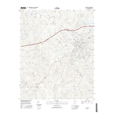
2017 Map of Gaffney
USGS Topo · Published 2017About this map
Gaffney serves as the focal point of this 2017 survey, showcasing its growth as a regional hub in Cherokee County. The landscape is defined by a dense network of residential streets and civic institutions, most notably Limestone Coll and several historic burial grounds such as Oakland Cem and Limestone Cem. To the north and west, the terrain shifts into a series of water management systems including Lake Whelchel and multiple watershed reservoirs along Thicketty Cr and Cherokee Cr. These features, alongside smaller settlements like Thicketty and East Gaffney, illustrate the transition from the city's urban core to the managed hydraulic landscapes of the surrounding Piedmont. Researchers can find numerous family-named cemeteries such as Byars Cem and Huskey Cem scattered across the rural tracts, providing valuable leads for genealogical study.
Find a feature on this map
236 named features on this map. Tap any name to fly to it.
Don’t see what you’re looking for? This feature index may not catch every label — zoom into the map to look around manually.
Map Details
Editions of this 2017 Gaffney Map
This is the sole edition of this map. No revisions or reprints were ever made.
Other maps of this area

1909 · Gaffney
USGS Topo · 1:62,500

1941 · Spartanburg
USGS Topo · 1:250,000

1947 · Spartanburg
USGS Topo · 1:62,500

1949 · Spartanburg
USGS Topo · 1:62,500

1953 · Spartanburg
USGS Topo · 1:250,000

1953 · Charlotte
USGS Topo · 1:250,000

1954 · Charlotte
USGS Topo · 1:250,000

1959 · Cowpens
USGS Topo · 1:62,500

1960 · Charlotte
USGS Topo · 1:250,000

1960 · Spartanburg
USGS Topo · 1:250,000