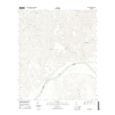
2014 Map of Gainestown
USGS Topo · Published 2014About this map
The Alabama River carves a sweeping path along the border of Clarke and Monroe Counties, defining the riverine character of this landscape in the early 21st century. The small settlement of Gainestown serves as a central hub, connected to the surrounding countryside by a network of rural roads such as Gainestown Rd and Walker Springs Rd. To the east, the community of Barlow Bend sits near the river's edge, where alluvial features like California Bar and Irvin Bar emerge in the channel. Genealogists can identify localized family and community landmarks, including Franks Cem and Road Cem, tucked away off wooded routes like Fools Acre Rd. The terrain is deeply dissected by numerous watercourses, from Sizemore Cr in the north to Wallers Cr and Fletcher Br in the south, illustrating the intricate drainage patterns that have shaped land use and property boundaries in this part of Alabama.
Find a feature on this map
48 named features on this map. Tap any name to fly to it.
Don’t see what you’re looking for? This feature index may not catch every label — zoom into the map to look around manually.
Map Details
Editions of this 2014 Gainestown Map
This is the sole edition of this map. No revisions or reprints were ever made.
Other maps of this area

1943 · Choctaw Bluff
USGS Topo · 1:62,500

1946 · Choctaw Bluff
USGS Topo · 1:62,500

1953 · Andalusia
USGS Topo · 1:250,000

1957 · Andalusia
USGS Topo · 1:250,000

1972 · Chrysler
USGS Topo · 1:24,000

1972 · Uriah West
USGS Topo · 1:24,000

1972 · Flynns Lake
USGS Topo · 1:24,000

1972 · Gainestown
USGS Topo · 1:24,000

1972 · Claiborne
USGS Topo · 1:24,000

1972 · Suggsville
USGS Topo · 1:24,000