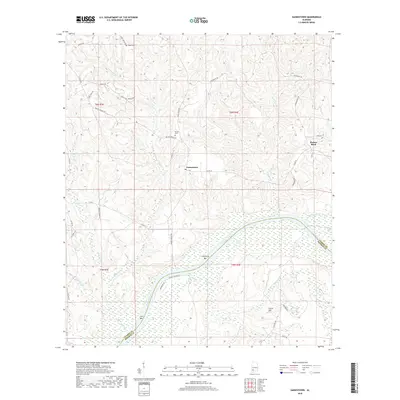
2018 Map of Gainestown
USGS Topo · Published 2018About this map
The Alabama River carves a sweeping path through the heart of this landscape, defining the border between Clarke and Monroe counties. The winding river system is marked by navigational landmarks like California Bar and Irvin Bar, while the surrounding wetlands and oxbows, including Scott Lake and Flynns Lake, show the dynamic nature of the river valley. The map documents the rural character of the region, anchored by the settlements of Gainestown and Barlow Bend.
Find a feature on this map
49 named features on this map. Tap any name to fly to it.
Don’t see what you’re looking for? This feature index may not catch every label — zoom into the map to look around manually.
Map Details
Editions of this 2018 Gainestown Map
This is the sole edition of this map. No revisions or reprints were ever made.
Other maps of this area

1943 · Choctaw Bluff
USGS Topo · 1:62,500

1946 · Choctaw Bluff
USGS Topo · 1:62,500

1953 · Andalusia
USGS Topo · 1:250,000

1957 · Andalusia
USGS Topo · 1:250,000

1972 · Chrysler
USGS Topo · 1:24,000

1972 · Uriah West
USGS Topo · 1:24,000

1972 · Flynns Lake
USGS Topo · 1:24,000

1972 · Gainestown
USGS Topo · 1:24,000

1972 · Claiborne
USGS Topo · 1:24,000

1972 · Suggsville
USGS Topo · 1:24,000