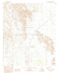
1990 Map of Gakolik Mountains
USGS Topo · Published 1991About this map
Papago Indian Reservation territory defines this high-desert landscape in Pima County, where the topography is dominated by two distinct mountain ranges. The northern portion is characterized by the rugged Sikort Chuapo Mountains, which give way to the lower Gakolik Mountains in the southeast. Between these peaks lie the broad drainage basins of Hickiwan Valley and Quijotoa Valley, illustrating the classic basin-and-range geography of southern Arizona. The settlement of Hotason Vo sits at the southern edge of the map, serving as a primary point of human occupation in an area otherwise marked by expansive terrain and intermittent watercourses. This provisional survey provides a look at the desert's natural drainage patterns and the isolated peaks that rise sharply from the valley floors.
Find a feature on this map
8 named features on this map. Tap any name to fly to it.
Don’t see what you’re looking for? This feature index may not catch every label — zoom into the map to look around manually.
Map Details
Editions of this 1990 Gakolik Mountains Map
This is the sole edition of this map. No revisions or reprints were ever made.
Other maps of this area

1953 · Ajo
USGS Topo · 1:250,000

1957 · Ajo
USGS Topo · 1:250,000

1958 · Ajo
USGS Topo · 1:250,000

1962 · Ajo
USGS Topo · 1:250,000

1963 · Ajo
USGS Topo · 1:250,000

1963 · Sikort Chuapo Mts
USGS Topo · 1:62,500

1963 · Mt. Ajo
USGS Topo · 1:62,500

1963 · Cimarron Peak
USGS Topo · 1:62,500

1963 · Pisinimo
USGS Topo · 1:62,500

1967 · Ajo
USGS Topo · 1:250,000