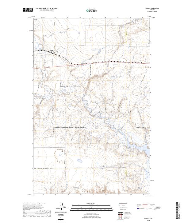
2024 Map of Galata
USGS Topo · Published 2024About this map
The town of Galata and the surrounding agricultural landscape of Toole and Liberty counties are defined by a complex network of coulees and seasonal drainage. This 2024 survey details the local infrastructure, including the town's Po and the nearby Galata Cem, which serves as a primary genealogical landmark for the region. The map reveals how the land is managed through water storage features like Mcintyre Reservoir and Gillespie Reservoir, essential in this semi-arid environment.
Find a feature on this map
29 named features on this map. Tap any name to fly to it.
Don’t see what you’re looking for? This feature index may not catch every label — zoom into the map to look around manually.
Map Details
Editions of this 2024 Galata Map
This is the sole edition of this map. No revisions or reprints were ever made.
Other maps of this area

1954 · Shelby
USGS Topo · 1:250,000

1958 · Shelby
USGS Topo · 1:250,000

1962 · North Lothair School
USGS Topo · 1:24,000

1962 · Mc Carters Lake
USGS Topo · 1:24,000

1962 · Mc Carters Lake SE
USGS Topo · 1:24,000

1970 · Pondera School
USGS Topo · 1:24,000

1970 · Devon
USGS Topo · 1:24,000

1970 · Galata
USGS Topo · 1:24,000
1970 · Denson Ranch
USGS Topo · 1:24,000

1970 · Lothair SW
USGS Topo · 1:24,000