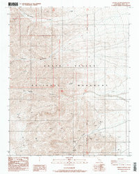
1987 Map of Galena Canyon
USGS Topo · Published 1988About this map
Death Valley National Monument encompasses the arid, high-relief terrain of the Panamint Range as it appeared in the late 1980s. This survey records a landscape defined by deep drainage systems and mineral exploration, notably within Galena Canyon and Starvation Canyon. The presence of several Prospects and a significant Open Pit Mine near the southern boundary reflects the region's enduring mining history, where geologic investigation and resource extraction often dictated human movement through these steep corridors. To the west, Gold Hill rises as a prominent landmark above the braided washes of Six Spring Canyon and the South Fork Johnson Canyon. The map preserves the exact location of these small-scale workings and remote natural springs before further modern changes to the monument's management and land status.
Find a feature on this map
10 named features on this map. Tap any name to fly to it.
Don’t see what you’re looking for? This feature index may not catch every label — zoom into the map to look around manually.
Map Details
Editions of this 1987 Galena Canyon Map
2 editions found
Other maps of this area

1908 · Furnace Creek
USGS Topo · 1:250,000

1908 · Ballarat
USGS Topo · 1:250,000

1910 · Furnace Creek
USGS Topo · 1:250,000

1913 · Ballarat
USGS Topo · 1:250,000

1915 · Searles Lake
USGS Topo · 1:250,000

1933 · Avawatz Mountains
USGS Topo · 1:250,000

1947 · Trona
USGS Topo · 1:250,000

1948 · Trona
USGS Topo · 1:250,000

1948 · Death Valley
USGS Topo · 1:250,000

1950 · Manly Peak
USGS Topo · 1:62,500