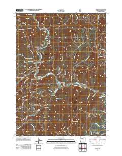
2011 Map of Galice
USGS Topo · Published 2011About this map
Galice sits along a winding stretch of the Rogue River, where steep gulches and mountain creeks define a landscape shaped by a legacy of resource extraction. This 2011 survey documents a region punctuated by numerous historic mining sites, such as the Almeda Mine near Almeda Bar and the Old Channel Mine further south. The settlement of Rand and the Hellgate Bridge serve as central points along the river corridor, while the higher elevations are marked by landmarks like Buckhorn Mountain and the Taylor Gorge Overlook. The intricate network of forest roads, including Galice Rd and various BLM routes, provides access to the many named gulches like Rich Gulch and Toss Gulch that drain into the Rogue. This map captures the modern footprint of a historically productive mining district, documenting the continued importance of the river and its rugged tributaries.
Find a feature on this map
82 named features on this map. Tap any name to fly to it.
Don’t see what you’re looking for? This feature index may not catch every label — zoom into the map to look around manually.
Map Details
Editions of this 2011 Galice Map
This is the sole edition of this map. No revisions or reprints were ever made.
Other maps of this area

1904 · Riddle
USGS Topo · 1:125,000

1908 · Grants Pass
USGS Topo · 1:125,000

1917 · Kerby
USGS Topo · 1:125,000

1918 · Kerby
USGS Topo · 1:125,000

1945 · Kerby
USGS Topo · 1:125,000

1946 · Galice
USGS Topo · 1:62,500

1948 · Galice
USGS Topo · 1:62,500

1954 · Glendale
USGS Topo · 1:62,500

1954 · Selma
USGS Topo · 1:62,500

1954 · Grants Pass
USGS Topo · 1:62,500