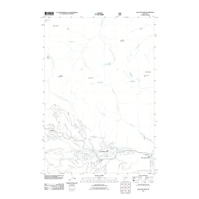
2011 Map of Gallatin Peak
USGS Topo · Published 2011About this map
Big Sky and its surrounding mountain developments are captured here at a moment of significant growth in the Gallatin Range. The landscape is defined by the high peaks of Gallatin Peak and Wilson Peak, which shadow a complex network of seasonal and residential roads such as Antler Ridge Rd and Ousel Falls Rd. The transition from ranching heritage to a mountain resort economy is evident in the presence of the Crail Ranch and B K Ranch alongside the Big Sky Meadow Village and the Big Sky Golf Course.
Find a feature on this map
55 named features on this map. Tap any name to fly to it.
Don’t see what you’re looking for? This feature index may not catch every label — zoom into the map to look around manually.
Map Details
Editions of this 2011 Gallatin Peak Map
This is the sole edition of this map. No revisions or reprints were ever made.
Other maps of this area

1888 · Three Forks
USGS Topo · 1:250,000

1894 · Three Forks
USGS Topo · 1:250,000

1895 · Three Forks
USGS Topo · 1:250,000

1947 · Bozeman
USGS Topo · 1:250,000

1948 · Bozeman
USGS Topo · 1:250,000

1950 · Spanish Peaks
USGS Topo · 1:62,500

1950 · Sphinx Mountain
USGS Topo · 1:62,500

1955 · Bozeman
USGS Topo · 1:250,000

1955 · Garnet Mountain
USGS Topo · 1:62,500

1955 · Crown Butte
USGS Topo · 1:62,500
Featured Places
- Big Sky, MT
- Big Sky Canyon Village, MT
- Big Sky Meadow Village, MT
- Gallatin County, MT
- Madison County, MT