
1955 Map of Garnet Mountain
USGS Topo · Published 1957About this map
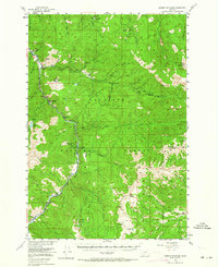
Gallatin Canyon serves as the primary corridor for movement through this high-elevation landscape during the mid-1950s, with U.S. 191 tracking the bends of the Gallatin River. The area is characterized by scattered recreational and administrative outposts within the Gallatin National Forest, including the Squaw Creek Ranger Sta and the Butte Meadows Ranger Sta. Resource extraction and mountain industry are evident via the Mica Mine, Asbestos Mine, and the Blanchard Sawmill located near the river banks.
Find a feature on this map
81 named features on this map. Tap any name to fly to it.
Don’t see what you’re looking for? This feature index may not catch every label — zoom into the map to look around manually.
Map Details
Editions of this 1955 Garnet Mountain Map
4 editions found
Other maps of this area

1888 · Three Forks
USGS Topo · 1:250,000

1891 · Livingston
USGS Topo · 1:250,000

1893 · Livingston
USGS Topo · 1:250,000

1894 · Three Forks
USGS Topo · 1:250,000

1895 · Three Forks
USGS Topo · 1:250,000

1947 · Bozeman
USGS Topo · 1:250,000

1948 · Bozeman
USGS Topo · 1:250,000

1949 · Anceney
USGS Topo · 1:62,500

1950 · Spanish Peaks
USGS Topo · 1:62,500

1950 · Sphinx Mountain
USGS Topo · 1:62,500