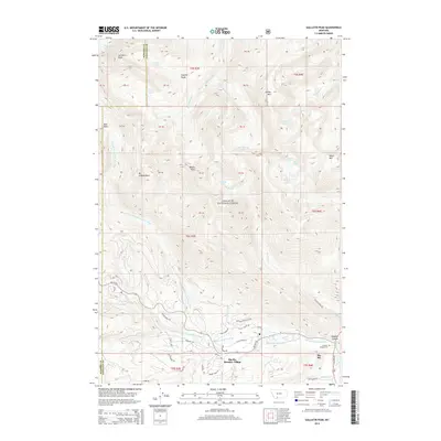
2014 Map of Gallatin Peak
USGS Topo · Published 2014About this map
Gallatin Peak and the high elevations of the Spanish Peaks define the northern reaches of this landscape, where the headwaters of the W Fork Gallatin River begin their descent. This 2014 survey captures the modern footprint of Big Sky and Big Sky Meadow Village, documenting a complex network of residential roads like Antler Ridge Rd and Little Coyote Rd tucked into the valley floor. Within the Gallatin National Forest, the map traces the drainage patterns of Hell Roaring Cr and Dudley Cr, alongside high-alpine features such as Lillian Lake and Hell-Roaring Lake. Local history is anchored by the Soldiers Chapel Cem near Gallatin Canyon, providing a point of reference for researchers and genealogists tracing the development of this mountain community.
Find a feature on this map
59 named features on this map. Tap any name to fly to it.
Don’t see what you’re looking for? This feature index may not catch every label — zoom into the map to look around manually.
Map Details
Editions of this 2014 Gallatin Peak Map
This is the sole edition of this map. No revisions or reprints were ever made.
Other maps of this area

1888 · Three Forks
USGS Topo · 1:250,000

1894 · Three Forks
USGS Topo · 1:250,000

1895 · Three Forks
USGS Topo · 1:250,000

1947 · Bozeman
USGS Topo · 1:250,000

1948 · Bozeman
USGS Topo · 1:250,000

1950 · Spanish Peaks
USGS Topo · 1:62,500

1950 · Sphinx Mountain
USGS Topo · 1:62,500

1955 · Bozeman
USGS Topo · 1:250,000

1955 · Garnet Mountain
USGS Topo · 1:62,500

1955 · Crown Butte
USGS Topo · 1:62,500
Featured Places
- Big Sky, MT
- Big Sky Canyon Village, MT
- Big Sky Meadow Village, MT
- Gallatin County, MT
- Madison County, MT