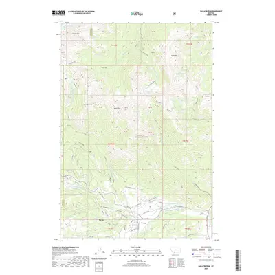
2020 Map of Gallatin Peak
USGS Topo · Published 2020About this map
Big Sky serves as the focal point of this modern survey, where the developing residential and resort infrastructure of t7s r3e meets the high-altitude wilderness of Gallatin National Forest. The map documents a dense network of mountain roads such as Andesite Rd and Chief Joseph Rd alongside specialized routes like the Bobsled Trl, illustrating the transition from local settlement to a major recreational destination. In the northern reaches, the terrain is dominated by the Spanish Peaks and the towering Gallatin Peak, surrounded by remote alpine waters like Lillian Lake and Hell Roaring Lake. The drainage systems are intricate, showing the headwaters of the W Fork Gallatin River and its various tributaries including Dudley Creek. Near the southern boundary, the Soldiers Chapel Cem stands as a notable landmark amidst the growing valley community.
Find a feature on this map
77 named features on this map. Tap any name to fly to it.
Don’t see what you’re looking for? This feature index may not catch every label — zoom into the map to look around manually.
Map Details
Editions of this 2020 Gallatin Peak Map
This is the sole edition of this map. No revisions or reprints were ever made.
Other maps of this area

1888 · Three Forks
USGS Topo · 1:250,000

1894 · Three Forks
USGS Topo · 1:250,000

1895 · Three Forks
USGS Topo · 1:250,000

1947 · Bozeman
USGS Topo · 1:250,000

1948 · Bozeman
USGS Topo · 1:250,000

1950 · Spanish Peaks
USGS Topo · 1:62,500

1950 · Sphinx Mountain
USGS Topo · 1:62,500

1955 · Bozeman
USGS Topo · 1:250,000

1955 · Garnet Mountain
USGS Topo · 1:62,500

1955 · Crown Butte
USGS Topo · 1:62,500
Featured Places
- Big Sky, MT
- Big Sky Canyon Village, MT
- Big Sky Meadow Village, MT
- Gallatin County, MT
- Madison County, MT