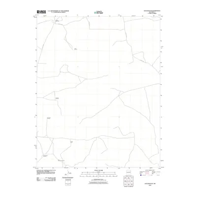
2010 Map of Gallegos NE
USGS Topo · Published 2010About this map
McCarty West Camp and Cooper Ranch anchor this landscape in Harding County, where the infrastructure of high-plains ranching is carefully documented. The map reveals a specialized network of water management essential for livestock, featuring named sites like School Section Windmills, South Windmill, and Rockwell Windmill. This 2010 survey illustrates how local geography is defined by these isolated outposts and the sparse road system connecting them, including County Road H and County Road I. The distribution of these features across the quadrangle suggests a territory of large landholdings and strategic water access, typified by the paired Twin Honeycutt Windmills and the North Baker Windmills in the southern reaches.
Find a feature on this map
10 named features on this map. Tap any name to fly to it.
Don’t see what you’re looking for? This feature index may not catch every label — zoom into the map to look around manually.
Map Details
Editions of this 2010 Gallegos NE Map
This is the sole edition of this map. No revisions or reprints were ever made.
Other maps of this area

1954 · Tucumcari
USGS Topo · 1:250,000

1958 · Tucumcari
USGS Topo · 1:250,000

1966 · Rosebud
USGS Topo · 1:24,000

1966 · Mc Carty Ranch
USGS Topo · 1:24,000

1966 · Mc Cloy Ranch
USGS Topo · 1:24,000

1969 · Gallegos
USGS Topo · 1:24,000

1969 · Gallegos NE
USGS Topo · 1:24,000

1969 · Buffalo Springs
USGS Topo · 1:24,000
1969 · Fuentes Ranch
USGS Topo · 1:24,000

1973 · Circle Bar Ranch
USGS Topo · 1:24,000