
1969 Map of Gallegos NE
USGS Topo · Published 1972About this map
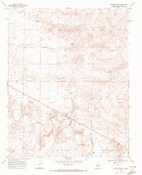
Cooper Ranch stands as the primary human landmark in this section of Harding County, illustrating the isolated ranching operations of the High Plains during the late 1960s. The landscape is defined by a critical network of water sources, essential for livestock in this arid environment. Named wells and windmills, such as the Twin Honeycutt Windmills, North Baker Windmills, and the School Section Windmills, are spaced across the terrain to support grazing. These labels often reflect local family names or specific land grants, such as East Romero Well and McCarty West Camp. The topography includes subtle relief features like Sage and Culbert, while man-made improvements are sparse, consisting mostly of primitive roads and fine fence lines that delineate vast tracts of range land.
Find a feature on this map
29 named features on this map. Tap any name to fly to it.
Don’t see what you’re looking for? This feature index may not catch every label — zoom into the map to look around manually.
Map Details
Editions of this 1969 Gallegos NE Map
This is the sole edition of this map. No revisions or reprints were ever made.
Other maps of this area

1954 · Tucumcari
USGS Topo · 1:250,000

1958 · Tucumcari
USGS Topo · 1:250,000

1966 · Rosebud
USGS Topo · 1:24,000

1966 · Mc Carty Ranch
USGS Topo · 1:24,000

1966 · Mc Cloy Ranch
USGS Topo · 1:24,000

1969 · Gallegos
USGS Topo · 1:24,000

1969 · Buffalo Springs
USGS Topo · 1:24,000
1969 · Fuentes Ranch
USGS Topo · 1:24,000

1973 · Circle Bar Ranch
USGS Topo · 1:24,000
1973 · Indian Bathtub
USGS Topo · 1:24,000