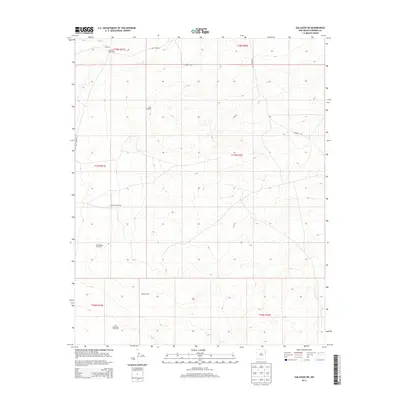
2013 Map of Gallegos NE
USGS Topo · Published 2013About this map
The high plains of Harding County are characterized by a network of ranching infrastructure and isolated camps in this 2013 survey. McCarty West Camp sits in the northern reaches, while Cooper Ranch occupies the southern terrain, illustrating the persistent cattle-rearing economy of the region. The map reveals the critical importance of water management in this arid landscape, documented through numerous named watering points such as South Windmill, Rockwell Windmill, and the Twin Honeycutt Windmills. Access is provided by several secondary routes including Salt Lakes Rd and Highwell Rd, which connect these remote operations. The land is precisely divided by township and range lines, such as t17n r31e and t18n r32e, reflecting the enduring Public Land Survey System structure that organizes this corner of New Mexico.
Find a feature on this map
15 named features on this map. Tap any name to fly to it.
Don’t see what you’re looking for? This feature index may not catch every label — zoom into the map to look around manually.
Map Details
Editions of this 2013 Gallegos NE Map
This is the sole edition of this map. No revisions or reprints were ever made.
Other maps of this area

1954 · Tucumcari
USGS Topo · 1:250,000

1958 · Tucumcari
USGS Topo · 1:250,000

1966 · Rosebud
USGS Topo · 1:24,000

1966 · Mc Carty Ranch
USGS Topo · 1:24,000

1966 · Mc Cloy Ranch
USGS Topo · 1:24,000

1969 · Gallegos
USGS Topo · 1:24,000

1969 · Gallegos NE
USGS Topo · 1:24,000

1969 · Buffalo Springs
USGS Topo · 1:24,000
1969 · Fuentes Ranch
USGS Topo · 1:24,000

1973 · Circle Bar Ranch
USGS Topo · 1:24,000