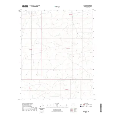
2020 Map of Gallegos NE
USGS Topo · Published 2020About this map
Circle Bar Ranch and several other cattle operations define the rural landscape of this northeastern New Mexico ranching country. The topography is marked by the presence of ephemeral water sources and landmarks like Indian Bathtub and Buffalo Springs, which indicate the critical importance of water rights and natural springs in this semi-arid environment. Access throughout the area is provided by local routes such as Salt Lakes Rd, Co Rd 1, and Co Rd 1-2.
Find a feature on this map
17 named features on this map. Tap any name to fly to it.
Don’t see what you’re looking for? This feature index may not catch every label — zoom into the map to look around manually.
Map Details
Editions of this 2020 Gallegos NE Map
This is the sole edition of this map. No revisions or reprints were ever made.
Other maps of this area

1954 · Tucumcari
USGS Topo · 1:250,000

1958 · Tucumcari
USGS Topo · 1:250,000

1966 · Rosebud
USGS Topo · 1:24,000

1966 · Mc Carty Ranch
USGS Topo · 1:24,000

1966 · Mc Cloy Ranch
USGS Topo · 1:24,000

1969 · Gallegos
USGS Topo · 1:24,000

1969 · Gallegos NE
USGS Topo · 1:24,000

1969 · Buffalo Springs
USGS Topo · 1:24,000
1969 · Fuentes Ranch
USGS Topo · 1:24,000

1973 · Circle Bar Ranch
USGS Topo · 1:24,000