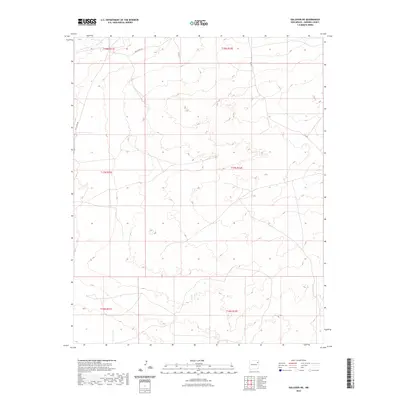
2023 Map of Gallegos NE
USGS Topo · Published 2023About this map
The high plains of Harding County define this landscape, where the survey lines of the Public Land Survey System carve out large tracts of New Mexico ranch land. Rural access is maintained via Salt Lakes Rd and Co Rd I-Z, which navigate the subtle topography of the northeastern corner of the state. This 2023 edition highlights a sparsely populated area characterized by open terrain and essential transit corridors like Co Rd 1 and Co Rd J. The map provides a precise layout of township and range boundaries, such as t17n r31e and t18n r32e, essential for researchers tracking land ownership and historical boundaries in this section of the High Plains.
Find a feature on this map
10 named features on this map. Tap any name to fly to it.
Don’t see what you’re looking for? This feature index may not catch every label — zoom into the map to look around manually.
Map Details
Editions of this 2023 Gallegos NE Map
This is the sole edition of this map. No revisions or reprints were ever made.
Other maps of this area

1954 · Tucumcari
USGS Topo · 1:250,000

1958 · Tucumcari
USGS Topo · 1:250,000

1966 · Rosebud
USGS Topo · 1:24,000

1966 · Mc Carty Ranch
USGS Topo · 1:24,000

1966 · Mc Cloy Ranch
USGS Topo · 1:24,000

1969 · Gallegos
USGS Topo · 1:24,000

1969 · Gallegos NE
USGS Topo · 1:24,000

1969 · Buffalo Springs
USGS Topo · 1:24,000
1969 · Fuentes Ranch
USGS Topo · 1:24,000

1973 · Circle Bar Ranch
USGS Topo · 1:24,000