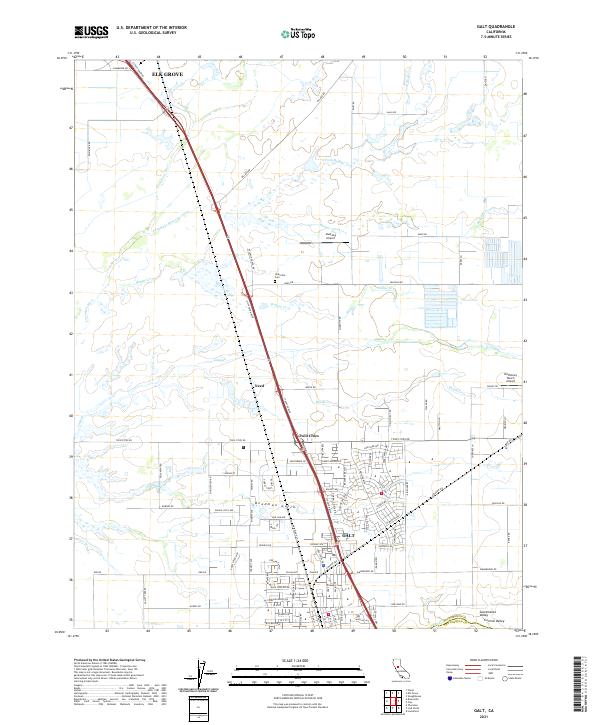
2021 Map of Galt
USGS Topo · Published 2021About this map
The city of Galt serves as the focal point of this modern survey, situated where the Central Valley landscape meets the Sacramento Co San Joaquin Co line. This region is defined by a dense network of seasonal waterways and overflow channels, most notably the Cosumnes River and its accompanying Cosumnes River Overflow, which cut through the northwest quadrant. The transit corridor of Stockton Blvd links the southern urban center with Twin Cities and the outlying settlement of Need, illustrating the historical development of the area along this north-south spine. Beyond the residential clusters, the land remains functional and rural, dotted with specialized sites like Mustang Airport and the Bottimore Ranch Airport. Smaller historical markers, such as the Hicksville Cem near Arno Rd, provide points of interest for genealogists tracing family roots in this part of northern California.
Find a feature on this map
110 named features on this map. Tap any name to fly to it.
Don’t see what you’re looking for? This feature index may not catch every label — zoom into the map to look around manually.
Map Details
Editions of this 2021 Galt Map
This is the sole edition of this map. No revisions or reprints were ever made.
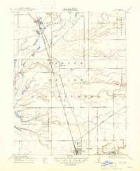
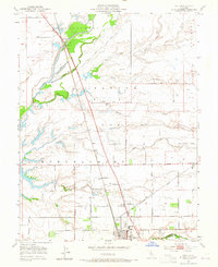
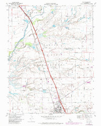
Historical Maps of Twin Cities Through Time
4 maps found