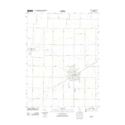
2012 Map of Galva
USGS Topo · Published 2012About this map
The town of Galva and the settlement of Bishop Hill anchor this Henry County landscape, where the agricultural grid is cut by the meandering paths of the S Edwards River and Goose Cr. This 2012 survey illustrates a region defined by its communal history and transportation lines. Bishop Hill is notably the site of a 19th-century utopian colony, and its nearby Bishop Hill Cemetery preserves the names of early residents. To the southeast, Galva serves as the primary hub, showing a dense street grid and the industrial legacy of Railroad Ave. Local landmarks like the Galva Autovue Theatre and multiple cemeteries including Saint Johns Cemetery and Galva Cemetery provide specific points of interest for genealogists and local historians tracking family lineage across this rural Illinois terrain.
Find a feature on this map
80 named features on this map. Tap any name to fly to it.
Don’t see what you’re looking for? This feature index may not catch every label — zoom into the map to look around manually.
Map Details
Editions of this 2012 Galva Map
This is the sole edition of this map. No revisions or reprints were ever made.
Other maps of this area

1929 · Annawan
USGS Topo · 1:62,500

1931 · Galva
USGS Topo · 1:48,000

1932 · Annawan
USGS Topo · 1:62,500

1934 · Geneseo
USGS Topo · 1:62,500

1940 · Galva
USGS Topo · 1:62,500

1944 · Galva
USGS Topo · 1:62,500

1944 · Kewanee
USGS Topo · 1:62,500

1953 · Nekoma
USGS Topo · 1:24,000

1953 · German Corner
USGS Topo · 1:24,000
1953 · Cambridge
USGS Topo · 1:24,000