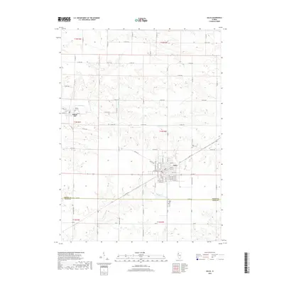
2018 Map of Galva
USGS Topo · Published 2018About this map
Galva sits as a significant rail and road hub in the heart of this agricultural landscape at the border of Henry Co and Knox Co. The town's grid is dense with street-level detail, including names like NW 5th St and W Division St, while the surrounding prairie is dissected by the meandering S Edwards River and its tributaries, Goose Cr and Mud Run. To the northwest, the historic community of Bishop Hill remains a distinct landmark, accompanied by the Bishop Hill Cem. The map's network of country roads, such as Bonham Rd and the intriguing Trolly Rd, traces the modern parcel boundaries of Section 14 through Section 35, showing the persistent influence of the Public Land Survey System on the Illinois countryside.
Find a feature on this map
79 named features on this map. Tap any name to fly to it.
Don’t see what you’re looking for? This feature index may not catch every label — zoom into the map to look around manually.
Map Details
Editions of this 2018 Galva Map
This is the sole edition of this map. No revisions or reprints were ever made.
Other maps of this area

1929 · Annawan
USGS Topo · 1:62,500

1931 · Galva
USGS Topo · 1:48,000

1932 · Annawan
USGS Topo · 1:62,500

1934 · Geneseo
USGS Topo · 1:62,500

1940 · Galva
USGS Topo · 1:62,500

1944 · Galva
USGS Topo · 1:62,500

1944 · Kewanee
USGS Topo · 1:62,500

1953 · Nekoma
USGS Topo · 1:24,000

1953 · German Corner
USGS Topo · 1:24,000
1953 · Cambridge
USGS Topo · 1:24,000