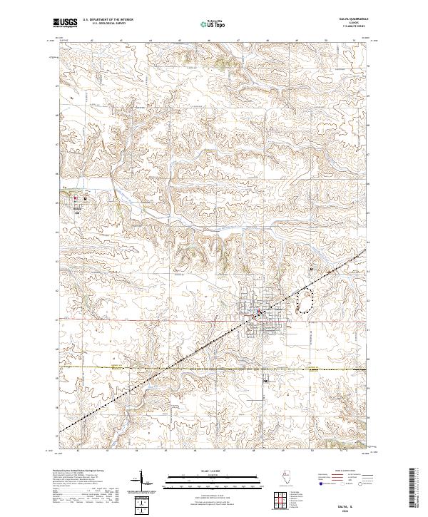
2024 Map of Galva
USGS Topo · Published 2024About this map
Galva serves as a primary hub of settlement in this part of Henry County, situated at the intersection of a grid-iron road network and the upper reaches of the South Edwards River. The landscape is defined by the drainage patterns of Goose Creek and Mud Run, which carve distinct paths through the agricultural countryside south of N 700th Ave. This map reveals the proximity of the historic Bishop Hill colony to the west, preserving the local geography surrounding the Bishop Hill Cemetery. Genealogists can also locate Saint Johns Cemetery and Galva Cemetery, while the presence of Trolly Road suggests the path of former transit lines that once connected these rural Illinois communities. The boundary line between Henry County and Knox County is clearly delineated across the southern section of the quadrangle.
Find a feature on this map
85 named features on this map. Tap any name to fly to it.
Don’t see what you’re looking for? This feature index may not catch every label — zoom into the map to look around manually.
Map Details
Editions of this 2024 Galva Map
This is the sole edition of this map. No revisions or reprints were ever made.
Other maps of this area

1929 · Annawan
USGS Topo · 1:62,500

1931 · Galva
USGS Topo · 1:48,000

1932 · Annawan
USGS Topo · 1:62,500

1934 · Geneseo
USGS Topo · 1:62,500

1940 · Galva
USGS Topo · 1:62,500

1944 · Galva
USGS Topo · 1:62,500

1944 · Kewanee
USGS Topo · 1:62,500

1953 · Nekoma
USGS Topo · 1:24,000

1953 · German Corner
USGS Topo · 1:24,000
1953 · Cambridge
USGS Topo · 1:24,000