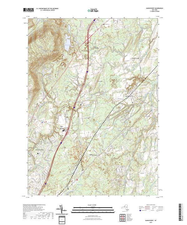
2023 Map of Gansevoort
USGS Topo · Published 2023About this map
Gansevoort serves as a central hub in this section of Saratoga County, where the landscape transitions from the elevations of the Palmertown Range and Grant Mountain in the northwest to the complex drainage basins of the Snook Kill and its various branches. This 2023 survey records a landscape shaped by significant water systems, including Moreau Lake and a dense network of brooks like Rice Brook and Gale Brook that define the local topography. For genealogists and local historians, the map is particularly rich in burial sites, documenting several established locations such as Gansevoort Cem, Wilton Cem, and the Brick Church Cem. Small settlements and named junctions like Ballard Corners, Fortsville, and Clarks Corner illustrate the enduring residential patterns of the region, while Heber Airpark and the modern corridor of Interstate 87 highlight the contemporary infrastructure that connects these historic communities.
Find a feature on this map
37 named features on this map. Tap any name to fly to it.
Don’t see what you’re looking for? This feature index may not catch every label — zoom into the map to look around manually.
Map Details
Editions of this 2023 Gansevoort Map
This is the sole edition of this map. No revisions or reprints were ever made.
Other maps of this area

1895 · Glens Falls
USGS Topo · 1:62,500

1897 · Glens Falls
USGS Topo · 1:62,500

1900 · Schuylerville
USGS Topo · 1:62,500

1902 · Saratoga
USGS Topo · 1:62,500

1903 · Luzerne
USGS Topo · 1:62,500
1934 · Quaker Springs
USGS Topo · 1:24,000

1934 · Saratoga Springs
USGS Topo · 1:24,000

1935 · Gansevoort
USGS Topo · 1:24,000
1935 · Schuylerville
USGS Topo · 1:24,000
1935 · Fort Miller
USGS Topo · 1:24,000