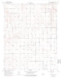
1960 Map of Garden City SW
USGS Topo · Published 1977About this map
The township boundaries of Sherlock and Ivanhoe divide this High Plains landscape, where industrial and agricultural patterns emerge from the 1958 and 1974 aerial surveys. The terrain is marked by a wide distribution of energy resources, with numerous Gas Wells and several Wells dotted across the sections, indicating the significance of the local gas field. For genealogists and local historians, the Goldamer Cem in section 23 stands as a primary point of interest, situated amidst a landscape largely defined by sections, fence lines, and field boundaries. The 1974 revisions, shown in purple, reveal the evolving footprint of irrigation ditches and rural structures that supported the region's agricultural economy during the mid-to-late 20th century.
Find a feature on this map
4 named features on this map. Tap any name to fly to it.
Don’t see what you’re looking for? This feature index may not catch every label — zoom into the map to look around manually.
Map Details
Editions of this 1960 Garden City SW Map
2 editions found

Other maps of this area

1891 · Larned
USGS Topo · 1:125,000

1896 · Garden
USGS Topo · 1:125,000

1900 · Lakin
USGS Topo · 1:125,000

1955 · Dodge City
USGS Topo · 1:250,000

1958 · Dodge City
USGS Topo · 1:250,000

1959 · Dodge City
USGS Topo · 1:250,000

1959 · Garden City 3 NW
USGS Topo · 1:24,000

1959 · Hickok NE
USGS Topo · 1:24,000

1959 · Garden City 3 NE
USGS Topo · 1:24,000

1960 · Garden City East
USGS Topo · 1:24,000