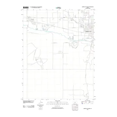
2009 Map of Garden City West
USGS Topo · Published 2009About this map
Garden City and the neighboring community of Holcomb anchor this Western Kansas landscape, where the agricultural grid meets the winding course of the Arkansas River. The 2009 survey shows the westward expansion of Garden City, with residential street networks like Zerr Rd and W Mary St filling in the space between the river and the historical transit corridors. This area is defined by its logistics and irrigation history, centered on the river valley and a dense system of access roads such as Old US Hwy 50 and Railroad Ave. Near the settlement of Quinby, the map documents local landmarks and thoroughfares like Vfw Rd and Holcomb River Rd, tracing the transition from industrial and rail-side development to the expansive open acreage that characterizes the region south of the river.
Find a feature on this map
42 named features on this map. Tap any name to fly to it.
Don’t see what you’re looking for? This feature index may not catch every label — zoom into the map to look around manually.
Map Details
Editions of this 2009 Garden City West Map
This is the sole edition of this map. No revisions or reprints were ever made.
Other maps of this area

1891 · Larned
USGS Topo · 1:125,000

1896 · Garden
USGS Topo · 1:125,000

1900 · Lakin
USGS Topo · 1:125,000

1944 · Tennis
USGS Topo · 1:62,500

1955 · Dodge City
USGS Topo · 1:250,000

1955 · Scott City
USGS Topo · 1:250,000

1958 · Dodge City
USGS Topo · 1:250,000

1958 · Scott City
USGS Topo · 1:250,000

1959 · Dodge City
USGS Topo · 1:250,000

1960 · Garden City East
USGS Topo · 1:24,000