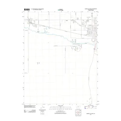
2012 Map of Garden City West
USGS Topo · Published 2012About this map
The Arkansas River meanders through this portion of western Kansas, defining the transition between the irrigated valley floor and the high plains of Finney County. The settlement of Holcomb serves as a primary hub in the west, anchored by the infrastructure of Railroad Ave, which follows the historic rail corridor parallel to the river. Further east, the community of Quinby sits near the intersection of several established rural thoroughfares, including Jones Ave and Cummings Rd. This 2012 survey illustrates the grid-based agricultural development of the region, where roads like N Sherlock Rd and N Anderson Rd partition the landscape into large productive tracts. Residential growth is evident in the cluster of named streets near the eastern boundary, such as Boots Rd and Eaman Rd, showing how modern subdivisions have begun to border traditional farm fields.
Find a feature on this map
78 named features on this map. Tap any name to fly to it.
Don’t see what you’re looking for? This feature index may not catch every label — zoom into the map to look around manually.
Map Details
Editions of this 2012 Garden City West Map
This is the sole edition of this map. No revisions or reprints were ever made.
Other maps of this area

1891 · Larned
USGS Topo · 1:125,000

1896 · Garden
USGS Topo · 1:125,000

1900 · Lakin
USGS Topo · 1:125,000

1944 · Tennis
USGS Topo · 1:62,500

1955 · Dodge City
USGS Topo · 1:250,000

1955 · Scott City
USGS Topo · 1:250,000

1958 · Dodge City
USGS Topo · 1:250,000

1958 · Scott City
USGS Topo · 1:250,000

1959 · Dodge City
USGS Topo · 1:250,000

1960 · Garden City East
USGS Topo · 1:24,000