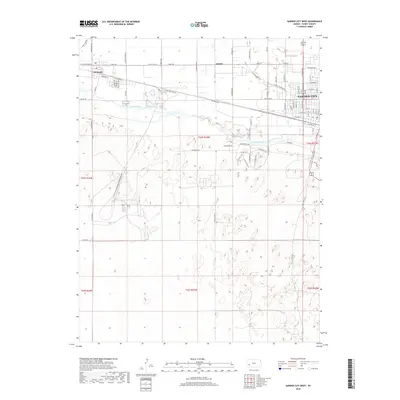
2018 Map of Garden City West
USGS Topo · Published 2018About this map
Garden City and the neighboring community of Holcomb anchor this landscape along the northern banks of the Arkansas River. This 2018 survey reveals the organized grid of the western edge of the city, transitioning from dense urban streets like W Kansas Ave and W Mary St into the broad agricultural sections of Finney County. The influence of early transit routes remains evident as Railroad Ave and Old US Hwy 50 parallel the river's path, dictating the development of settlements such as Quinby. The terrain south of the river is characterized by the winding hydrography and sandy areas typical of the High Plains, where rural roads like Holcomb River Rd follow the natural contours of the valley. For researchers, the map provides a precise record of late 2010s infrastructure, including the intersections of N Little Lowe Rd and W Taylor Jones Rd that define the local ranching and farming boundaries.
Find a feature on this map
77 named features on this map. Tap any name to fly to it.
Don’t see what you’re looking for? This feature index may not catch every label — zoom into the map to look around manually.
Map Details
Editions of this 2018 Garden City West Map
This is the sole edition of this map. No revisions or reprints were ever made.
Other maps of this area

1891 · Larned
USGS Topo · 1:125,000

1896 · Garden
USGS Topo · 1:125,000

1900 · Lakin
USGS Topo · 1:125,000

1944 · Tennis
USGS Topo · 1:62,500

1955 · Dodge City
USGS Topo · 1:250,000

1955 · Scott City
USGS Topo · 1:250,000

1958 · Dodge City
USGS Topo · 1:250,000

1958 · Scott City
USGS Topo · 1:250,000

1959 · Dodge City
USGS Topo · 1:250,000

1960 · Garden City East
USGS Topo · 1:24,000