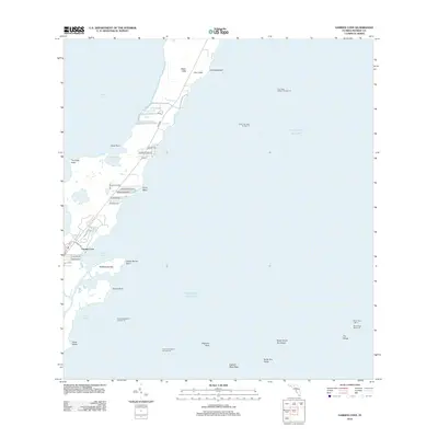
2012 Map of Garden Cove
USGS Topo · Published 2012About this map
Key Largo’s narrow northern reaches define the geography of this coastal area, where the land sits between the sheltered waters of Barnes Sound and the open Atlantic Ocean. The residential development at Garden Cove is concentrated along the shore, with local streets like S Exuma Rd and S Andros Rd providing access to the waterfront. Further north, the landscape transitions into the elevations of Basin Hills and the marshes surrounding Lake Simmons.
Find a feature on this map
43 named features on this map. Tap any name to fly to it.
Don’t see what you’re looking for? This feature index may not catch every label — zoom into the map to look around manually.
Map Details
Editions of this 2012 Garden Cove Map
This is the sole edition of this map. No revisions or reprints were ever made.
Other maps of this area

1947 · Garden Cove
USGS Topo · 1:24,000

1947 · Rock Harbor
USGS Topo · 1:24,000

1947 · Blackwater Sound
USGS Topo · 1:24,000

1949 · Blackwater Sound
USGS Topo · 1:24,000

1949 · Rock Harbor
USGS Topo · 1:24,000

1949 · Garden Cove
USGS Topo · 1:24,000

1949 · Card Sound
USGS Topo · 1:24,000

1949 · Pacific Reef
USGS Topo · 1:24,000

1950 · Glades
USGS Topo · 1:24,000

1956 · Card Sound
USGS Topo · 1:24,000